Sauzal geodata
Sauzal (Canary Islands) is a populated place; located in Spain in Atlantic/Canary (GMT+1) time zone. With population of 8,172 people, there are 925 cities with bigger population in this country. Compared to other cities in Spain, 99% of cities are located further ↑North; 99.2% of cities are located further →East and 52.1% of cities have lower elevation than Sauzal. Note1
Administrative division(s):
- Level 1: Canary Islands
- Level 2: Provincia de Santa Cruz de Tenerife
- Level 3: Sauzal, El


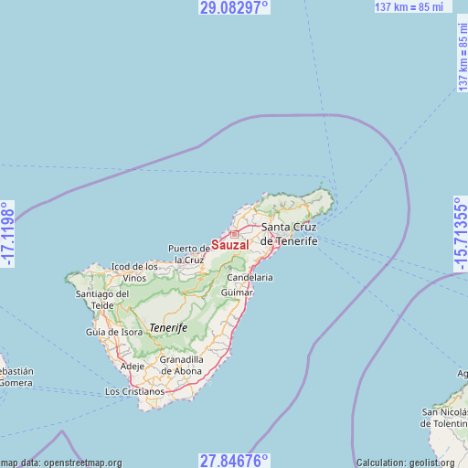
Sauzal GPS coordinates[2]
28° 28' 0.012" North, 16° 25' 0.012" West
| Map corner | latitude | longitude |
|---|---|---|
| Upper-left | 29.08297°, | -17.1198° |
| Center: | 28.46667°, | -16.41667° |
| Lower-right: | 27.84676°, | -15.71355° |
| Map W x H: | 137.5×137.5 km | = 85.4×85.4mi |
| max Lat: | 43.74134° ⇑99% North |
| Sauzal: | 28.46667° |
| min Lat: | ⇓1% South 27.64134° |
| min Long | Sauzal | max Long |
| -18.00367° | -16.41667° | 4.2899° |
| W 0.8%⇐ | ⇒99.2% E |
Elevation
Elevation of Sauzal is 681 m = 2234 ft, and this is 83 m = 272 ft above average elevation for this country.
| Max E: |
1682 m = 5518 ft | 47.9% |
| Sauzal | 681 m 2234 ft | |
| Avg. | 598 m = 1962 ft | |
Min E: |
0 m = 0 ft | 52.1% |
See also: Spain elevation on elevation.city.
Geographical zone
Sauzal is located in North temperate zone (between Tropic of Cancer and the Arctic Circle). Distance of this Northern Tropic circle is 559.3 km =347.5 mi to South.| Distance of | km | miles | from Sauzal |
|---|---|---|---|
| North Pole | 6841.9 | 4251.4 | to North |
| Arctic Circle | 4236 | 2632.1 | to North |
| Tropic Cancer | 559.3 | 347.5 | to South |
| Equator | 3165.2 | 1966.8 | to South |


Nearby cities:
15 places around Sauzal: (largest is in red/bold)
• Arafo
14.1 km =8.8 mi,  182°
182°
• Candelaria
13.2 km =8.2 mi,  160°
160°
• Güimar
17.3 km =10.7 mi, 178°
• La Laguna
9.7 km =6 mi,  77°
77°
• La Matanza de Acentejo
3.4 km =2.1 mi,  242°
242°
• La Orotava
13.4 km =8.3 mi,  230°
230°
• La Victoria de Acentejo
5.9 km =3.7 mi, 229°
• Los Realejos
18.6 km =11.6 mi, 240°
• Puerto de la Cruz
14.2 km =8.8 mi,  245°
245°
• Realejo Alto
19.3 km =12 mi, 238°
• San Juan de la Rambla
24.3 km =15.1 mi, 250°
• Santa Cruz de Tenerife
15.8 km =9.8 mi,  89°
89°
• Santa Úrsula
8.4 km =5.2 mi, 237°
• Tacoronte
1.3 km =0.8 mi,  29°
29°
• Tegueste
11.2 km =7 mi,  60°
60°
In other languages:
- In Spanish: El Sauzal
- In France: El Sauzal
- In German: El Sauzal
- In Italian: El Sauzal
Sources, notices
• [Note1] Compared only with cities in Spain existing in our database
• [Src1] Map data: © OpenStreetMap contributors (CC-BY-SA)
• [Src2] Other city data from geonames.org with taken over terms of usage.
• [Src3] Geographical zone / Annual Mean Temperature by Robert A. Rohde @ Wikipedia
