Rada de Haro geodata
Rada de Haro (Castille-La Mancha) is a seat of a third-order administrative division; located in Spain in Europe/Madrid (GMT+2) time zone. With population of 65 people, there are 6290 cities with bigger population in this country. Compared to other cities in Spain, 76% of cities are located further ↑North; 59.6% of cities are located further ←West and 71.6% of cities have lower elevation than Rada de Haro. Note1
Administrative division(s):
- Level 1: Castille-La Mancha
- Level 2: Provincia de Cuenca
- Level 3: Rada de Haro


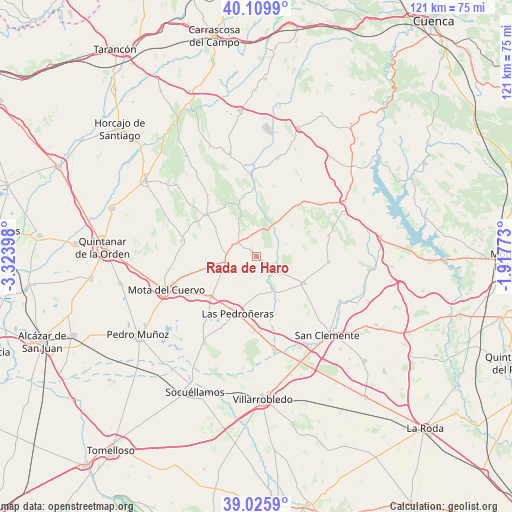
Rada de Haro GPS coordinates[2]
39° 34' 12.072" North, 2° 37' 15.096" West
| Map corner | latitude | longitude |
|---|---|---|
| Upper-left | 40.1099°, | -3.32398° |
| Center: | 39.57002°, | -2.62086° |
| Lower-right: | 39.0259°, | -1.91773° |
| Map W x H: | 120.5×120.5 km | = 74.9×74.9mi |
| max Lat: | 43.74134° ⇑76% North |
| Rada de Haro: | 39.57002° |
| min Lat: | ⇓24% South 27.64134° |
| min Long | Rada de Haro | max Long |
| -18.00367° | -2.62086° | 4.2899° |
| W 59.6%⇐ | ⇒40.4% E |
Elevation
Elevation of Rada de Haro is 825 m = 2707 ft, and this is 227 m = 745 ft above average elevation for this country.
| Max E: |
1682 m = 5518 ft | 28.4% |
| Rada de Haro | 825 m 2707 ft | |
| Avg. | 598 m = 1962 ft | |
Min E: |
0 m = 0 ft | 71.6% |
See also: Spain elevation on elevation.city.
Geographical zone
Rada de Haro is located in North temperate zone (between Tropic of Cancer and the Arctic Circle). Distance of this Northern Tropic circle is 1793.9 km =1114.7 mi to South.| Distance of | km | miles | from Rada de Haro |
|---|---|---|---|
| North Pole | 5607.3 | 3484.2 | to North |
| Arctic Circle | 3001.4 | 1865 | to North |
| Tropic Cancer | 1793.9 | 1114.7 | to South |
| Equator | 4399.8 | 2733.9 | to South |


Nearby cities:
15 places around Rada de Haro: (largest is in red/bold)
• Alconchel de la Estrella
17.1 km =10.6 mi,  13°
13°
• Belmonte
7.3 km =4.5 mi,  258°
258°
• Carrascosa de Haro
7.4 km =4.6 mi,  65°
65°
• El Pedernoso
14.3 km =8.9 mi,  228°
228°
• Fuentelespino de Haro
13.9 km =8.6 mi,  342°
342°
• La Alberca de Záncara
12.6 km =7.8 mi,  119°
119°
• Las Pedroñeras
14.1 km =8.8 mi,  198°
198°
• Los Hinojosos
18 km =11.2 mi,  282°
282°
• Monreal del Llano
12 km =7.5 mi,  269°
269°
• Osa de la Vega
15.5 km =9.6 mi,  309°
309°
• Pinarejo
17.5 km =10.9 mi, 72°
• Santa María del Campo Rus
17 km =10.6 mi,  93°
93°
• Villaescusa de Haro
5.5 km =3.4 mi, 305°
• Villalgordo del Marquesado
15.8 km =9.8 mi,  37°
37°
• Villar de la Encina
11.3 km =7 mi,  48°
48°
Sources, notices
• [Note1] Compared only with cities in Spain existing in our database
• [Src1] Map data: © OpenStreetMap contributors (CC-BY-SA)
• [Src2] Other city data from geonames.org with taken over terms of usage.
• [Src3] Geographical zone / Annual Mean Temperature by Robert A. Rohde @ Wikipedia
