Pinarejo geodata
Pinarejo (Castille-La Mancha) is a seat of a third-order administrative division; located in Spain in Europe/Madrid (GMT+2) time zone. With population of 352 people, there are 4309 cities with bigger population in this country. Compared to other cities in Spain, 75.5% of cities are located further ↑North; 61.9% of cities are located further ←West and 77.1% of cities have lower elevation than Pinarejo. Note1
Administrative division(s):
- Level 1: Castille-La Mancha
- Level 2: Provincia de Cuenca
- Level 3: Pinarejo


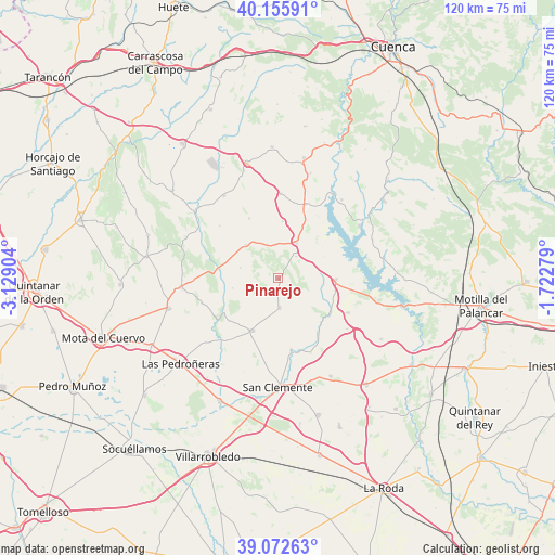
Pinarejo GPS coordinates[2]
39° 36' 59.004" North, 2° 25' 33.312" West
| Map corner | latitude | longitude |
|---|---|---|
| Upper-left | 40.15591°, | -3.12904° |
| Center: | 39.61639°, | -2.42592° |
| Lower-right: | 39.07263°, | -1.72279° |
| Map W x H: | 120.4×120.4 km | = 74.8×74.8mi |
| max Lat: | 43.74134° ⇑75.5% North |
| Pinarejo: | 39.61639° |
| min Lat: | ⇓24.5% South 27.64134° |
| min Long | Pinarejo | max Long |
| -18.00367° | -2.42592° | 4.2899° |
| W 61.9%⇐ | ⇒38.1% E |
Elevation
Elevation of Pinarejo is 871 m = 2858 ft, and this is 273 m = 896 ft above average elevation for this country.
| Max E: |
1682 m = 5518 ft | 22.9% |
| Pinarejo | 871 m 2858 ft | |
| Avg. | 598 m = 1962 ft | |
Min E: |
0 m = 0 ft | 77.1% |
See also: Spain elevation on elevation.city.
Geographical zone
Pinarejo is located in North temperate zone (between Tropic of Cancer and the Arctic Circle). Distance of this Northern Tropic circle is 1799 km =1117.8 mi to South.| Distance of | km | miles | from Pinarejo |
|---|---|---|---|
| North Pole | 5602.1 | 3481 | to North |
| Arctic Circle | 2996.2 | 1861.8 | to North |
| Tropic Cancer | 1799 | 1117.8 | to South |
| Equator | 4404.9 | 2737.1 | to South |


Nearby cities:
15 places around Pinarejo: (largest is in red/bold)
• Alconchel de la Estrella
17.1 km =10.6 mi,  312°
312°
• Atalaya del Cañavate
18.5 km =11.5 mi,  126°
126°
• Carrascosa de Haro
10.1 km =6.3 mi,  258°
258°
• Castillo de Garcimuñoz
6.2 km =3.9 mi,  39°
39°
• Cervera del Llano
18.5 km =11.5 mi,  1°
1°
• Honrubia
12.4 km =7.7 mi,  91°
91°
• La Alberca de Záncara
12.7 km =7.9 mi,  206°
206°
• La Almarcha
8.7 km =5.4 mi,  26°
26°
• Montalbanejo
14.5 km =9 mi,  334°
334°
• Olivares de Júcar
17.2 km =10.7 mi,  20°
20°
• Rada de Haro
17.5 km =10.9 mi,  252°
252°
• Santa María del Campo Rus
6.3 km =3.9 mi,  177°
177°
• Torrubia del Castillo
10.8 km =6.7 mi,  64°
64°
• Villalgordo del Marquesado
10.2 km =6.3 mi,  315°
315°
• Villar de la Encina
8.5 km =5.3 mi,  285°
285°
Sources, notices
• [Note1] Compared only with cities in Spain existing in our database
• [Src1] Map data: © OpenStreetMap contributors (CC-BY-SA)
• [Src2] Other city data from geonames.org with taken over terms of usage.
• [Src3] Geographical zone / Annual Mean Temperature by Robert A. Rohde @ Wikipedia
