Poblete geodata
Poblete (Castille-La Mancha) is a seat of a third-order administrative division; located in Spain in Europe/Madrid (GMT+2) time zone. With population of 964 people, there are 2994 cities with bigger population in this country. Compared to other cities in Spain, 81.7% of cities are located further ↑North; 59.4% of cities are located further →East and 52.9% of cities have higher elevation than Poblete. Note1
Administrative division(s):
- Level 1: Castille-La Mancha
- Level 2: Provincia de Ciudad Real
- Level 3: Poblete


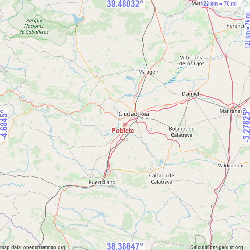
Poblete GPS coordinates[2]
38° 56' 7.8" North, 3° 58' 52.932" West
| Map corner | latitude | longitude |
|---|---|---|
| Upper-left | 39.48032°, | -4.6845° |
| Center: | 38.9355°, | -3.98137° |
| Lower-right: | 38.38647°, | -3.27825° |
| Map W x H: | 121.6×121.6 km | = 75.6×75.6mi |
| max Lat: | 43.74134° ⇑81.7% North |
| Poblete: | 38.9355° |
| min Lat: | ⇓18.3% South 27.64134° |
| min Long | Poblete | max Long |
| -18.00367° | -3.98137° | 4.2899° |
| W 40.6%⇐ | ⇒59.4% E |
Elevation
Elevation of Poblete is 625 m = 2051 ft, and this is 27 m = 89 ft above average elevation for this country.
| Max E: |
1682 m = 5518 ft | 52.9% |
| Poblete | 625 m 2051 ft | |
| Avg. | 598 m = 1962 ft | |
Min E: |
0 m = 0 ft | 47.1% |
See also: Spain elevation on elevation.city.
Geographical zone
Poblete is located in North temperate zone (between Tropic of Cancer and the Arctic Circle). Distance of this Northern Tropic circle is 1723.3 km =1070.8 mi to South.| Distance of | km | miles | from Poblete |
|---|---|---|---|
| North Pole | 5677.8 | 3528 | to North |
| Arctic Circle | 3072 | 1908.9 | to North |
| Tropic Cancer | 1723.3 | 1070.8 | to South |
| Equator | 4329.2 | 2690 | to South |


Nearby cities:
15 places around Poblete: (largest is in red/bold)
• Alcolea de Calatrava
13 km =8.1 mi,  296°
296°
• Almagro
23.9 km =14.9 mi,  102°
102°
• Argamasilla de Calatrava
24.3 km =15.1 mi,  199°
199°
• Ballesteros de Calatrava
11.7 km =7.3 mi,  164°
164°
• Carrión de Calatrava
17 km =10.6 mi,  56°
56°
• Cañada de Calatrava
9.7 km =6 mi, 200°
• Ciudad Real
7.2 km =4.5 mi,  38°
38°
• Corral de Calatrava
12.2 km =7.6 mi,  225°
225°
• Miguelturra
8.5 km =5.3 mi,  67°
67°
• Picón
14.5 km =9 mi,  331°
331°
• Piedrabuena
20.1 km =12.5 mi, 303°
• Torralba de Calatrava
21.9 km =13.6 mi, 65°
• Valenzuela de Calatrava
20.3 km =12.6 mi,  116°
116°
• Villamayor de Calatrava
21.3 km =13.2 mi,  219°
219°
• Villar del Pozo
9.6 km =6 mi,  171°
171°
Sources, notices
• [Note1] Compared only with cities in Spain existing in our database
• [Src1] Map data: © OpenStreetMap contributors (CC-BY-SA)
• [Src2] Other city data from geonames.org with taken over terms of usage.
• [Src3] Geographical zone / Annual Mean Temperature by Robert A. Rohde @ Wikipedia
