Ciudad Real geodata
Ciudad Real (Castille-La Mancha) is a seat of a second-order administrative division; located in Spain in Europe/Madrid (GMT+2) time zone. With population of 74,014 people, there are 125 cities with bigger population in this country. Compared to other cities in Spain, 81% of cities are located further ↑North; 58.7% of cities are located further →East and 52.3% of cities have higher elevation than Ciudad Real. Note1
Administrative division(s):
- Level 1: Castille-La Mancha
- Level 2: Provincia de Ciudad Real
- Level 3: Ciudad Real


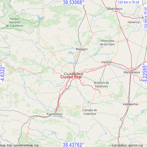
Ciudad Real GPS coordinates[2]
38° 59' 10.536" North, 3° 55' 44.652" West
| Map corner | latitude | longitude |
|---|---|---|
| Upper-left | 39.53068°, | -4.6322° |
| Center: | 38.98626°, | -3.92907° |
| Lower-right: | 38.43762°, | -3.22595° |
| Map W x H: | 121.5×121.5 km | = 75.5×75.5mi |
| max Lat: | 43.74134° ⇑81% North |
| Ciudad Real: | 38.98626° |
| min Lat: | ⇓19% South 27.64134° |
| min Long | Ciudad Real | max Long |
| -18.00367° | -3.92907° | 4.2899° |
| W 41.3%⇐ | ⇒58.7% E |
Elevation
Elevation of Ciudad Real is 633 m = 2077 ft, and this is 35 m = 115 ft above average elevation for this country.
| Max E: |
1682 m = 5518 ft | 52.3% |
| Ciudad Real | 633 m 2077 ft | |
| Avg. | 598 m = 1962 ft | |
Min E: |
0 m = 0 ft | 47.7% |
See also: Ciudad Real elevation on elevation.city.
Geographical zone
Ciudad Real is located in North temperate zone (between Tropic of Cancer and the Arctic Circle). Distance of this Northern Tropic circle is 1728.9 km =1074.3 mi to South.| Distance of | km | miles | from Ciudad Real |
|---|---|---|---|
| North Pole | 5672.2 | 3524.5 | to North |
| Arctic Circle | 3066.3 | 1905.3 | to North |
| Tropic Cancer | 1728.9 | 1074.3 | to South |
| Equator | 4334.9 | 2693.6 | to South |


Nearby cities:
15 places around Ciudad Real: (largest is in red/bold)
• Alcolea de Calatrava
16.2 km =10.1 mi,  270°
270°
• Almagro
21.7 km =13.5 mi,  119°
119°
• Ballesteros de Calatrava
16.9 km =10.5 mi,  184°
184°
• Carrión de Calatrava
10.4 km =6.5 mi,  69°
69°
• Cañada de Calatrava
16.7 km =10.4 mi,  208°
208°
• Corral de Calatrava
19.4 km =12.1 mi,  222°
222°
• Fuencaliente
23.7 km =14.7 mi,  339°
339°
• Malagón
21.1 km =13.1 mi,  17°
17°
• Miguelturra
4.1 km =2.5 mi,  126°
126°
• Picón
13.5 km =8.4 mi,  302°
302°
• Piedrabuena
21.9 km =13.6 mi,  284°
284°
• Poblete
7.2 km =4.5 mi, 218°
• Torralba de Calatrava
15.8 km =9.8 mi,  77°
77°
• Valenzuela de Calatrava
20.1 km =12.5 mi,  137°
137°
• Villar del Pozo
15.4 km =9.6 mi,  191°
191°
Sources, notices
• [Note1] Compared only with cities in Spain existing in our database
• [Src1] Map data: © OpenStreetMap contributors (CC-BY-SA)
• [Src2] Other city data from geonames.org with taken over terms of usage.
• [Src3] Geographical zone / Annual Mean Temperature by Robert A. Rohde @ Wikipedia
