Atalaya del Cañavate geodata
Atalaya del Cañavate (Castille-La Mancha) is a seat of a third-order administrative division; located in Spain in Europe/Madrid (GMT+2) time zone. With population of 115 people, there are 5757 cities with bigger population in this country. Compared to other cities in Spain, 76.7% of cities are located further ↑North; 64.1% of cities are located further ←West and 70.9% of cities have lower elevation than Atalaya del Cañavate. Note1
Administrative division(s):
- Level 1: Castille-La Mancha
- Level 2: Provincia de Cuenca
- Level 3: Atalaya del Cañavate


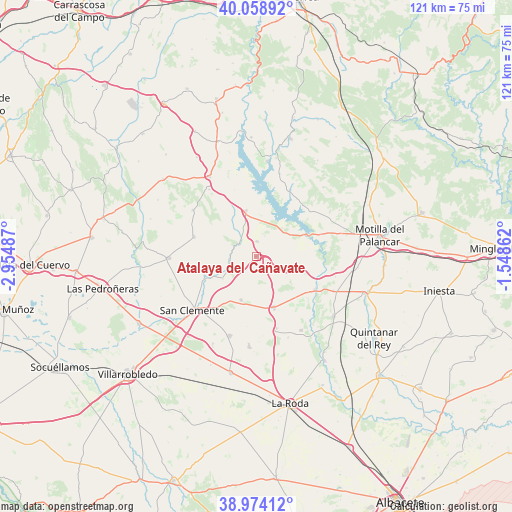
Atalaya del Cañavate GPS coordinates[2]
39° 31' 7.104" North, 2° 15' 6.3" West
| Map corner | latitude | longitude |
|---|---|---|
| Upper-left | 40.05892°, | -2.95487° |
| Center: | 39.51864°, | -2.25175° |
| Lower-right: | 38.97412°, | -1.54862° |
| Map W x H: | 120.6×120.6 km | = 74.9×74.9mi |
| max Lat: | 43.74134° ⇑76.7% North |
| Atalaya del Cañavate: | 39.51864° |
| min Lat: | ⇓23.3% South 27.64134° |
| min Long | Atalaya del Ca� | max Long |
| -18.00367° | -2.25175° | 4.2899° |
| W 64.1%⇐ | ⇒35.9% E |
Elevation
Elevation of Atalaya del Cañavate is 820 m = 2690 ft, and this is 222 m = 728 ft above average elevation for this country.
| Max E: |
1682 m = 5518 ft | 29.1% |
| Atalaya del Cañavate | 820 m 2690 ft | |
| Avg. | 598 m = 1962 ft | |
Min E: |
0 m = 0 ft | 70.9% |
See also: Spain elevation on elevation.city.
Geographical zone
Atalaya del Cañavate is located in North temperate zone (between Tropic of Cancer and the Arctic Circle). Distance of this Northern Tropic circle is 1788.1 km =1111.1 mi to South.| Distance of | km | miles | from Atalaya del Cañavate |
|---|---|---|---|
| North Pole | 5613 | 3487.8 | to North |
| Arctic Circle | 3007.1 | 1868.5 | to North |
| Tropic Cancer | 1788.1 | 1111.1 | to South |
| Equator | 4394.1 | 2730.4 | to South |


Nearby cities:
15 places around Atalaya del Cañavate: (largest is in red/bold)
• Alarcón
14.9 km =9.3 mi,  76°
76°
• Buenache de Alarcón
16.3 km =10.1 mi,  26°
26°
• Casas de Benítez
19.7 km =12.2 mi,  148°
148°
• Casas de Fernando Alonso
19.7 km =12.2 mi,  198°
198°
• Castillo de Garcimuñoz
19.1 km =11.9 mi,  324°
324°
• El Picazo
16.3 km =10.1 mi,  117°
117°
• Honrubia
10.8 km =6.7 mi,  346°
346°
• Olmedilla de Alarcón
17 km =10.6 mi,  50°
50°
• Pinarejo
18.5 km =11.5 mi,  306°
306°
• Pozoamargo
17.7 km =11 mi,  164°
164°
• Santa María del Campo Rus
15.4 km =9.6 mi,  287°
287°
• Sisante
13 km =8.1 mi, 160°
• Torrubia del Castillo
16.4 km =10.2 mi,  341°
341°
• Tébar
7.6 km =4.7 mi,  105°
105°
• Vara de Rey
10.9 km =6.8 mi, 199°
Sources, notices
• [Note1] Compared only with cities in Spain existing in our database
• [Src1] Map data: © OpenStreetMap contributors (CC-BY-SA)
• [Src2] Other city data from geonames.org with taken over terms of usage.
• [Src3] Geographical zone / Annual Mean Temperature by Robert A. Rohde @ Wikipedia
