Palomares del Río geodata
Palomares del Río (Andalusia) is a seat of a third-order administrative division; located in Spain in Europe/Madrid (GMT+2) time zone. With population of 4,782 people, there are 1347 cities with bigger population in this country. Compared to other cities in Spain, 92.8% of cities are located further ↑North; 86.8% of cities are located further →East and 92.9% of cities have higher elevation than Palomares del Río. Note1
Administrative division(s):
- Level 1: Andalusia
- Level 2: Provincia de Sevilla
- Level 3: Palomares del Río


Palomares del Río GPS coordinates[2]
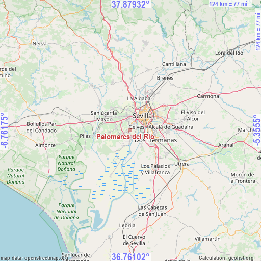
37° 19' 20.1" North, 6° 3' 31.068" West
| Map corner | latitude | longitude |
|---|---|---|
| Upper-left | 37.87932°, | -6.76175° |
| Center: | 37.32225°, | -6.05863° |
| Lower-right: | 36.76102°, | -5.3555° |
| Map W x H: | 124.3×124.3 km | = 77.2×77.2mi |
| max Lat: | 43.74134° ⇑92.8% North |
| Palomares del Río: | 37.32225° |
| min Lat: | ⇓7.2% South 27.64134° |
| min Long | Palomares del R | max Long |
| -18.00367° | -6.05863° | 4.2899° |
| W 13.2%⇐ | ⇒86.8% E |
Elevation
Elevation of Palomares del Río is 39 m = 128 ft, and this is 559 m = 1834 ft below average elevation for this country.
| Max E: |
1682 m = 5518 ft | 92.9% |
| Avg. | 598 m = 1962 ft | |
| Palomares del Río | 39 m = 128 ft | |
Min E: |
0 m = 0 ft | 7.1% |
See also: Spain elevation on elevation.city.
Geographical zone
Palomares del Río is located in North temperate zone (between Tropic of Cancer and the Arctic Circle). Distance of this Northern Tropic circle is 1543.9 km =959.3 mi to South.| Distance of | km | miles | from Palomares del Río |
|---|---|---|---|
| North Pole | 5857.2 | 3639.5 | to North |
| Arctic Circle | 3251.3 | 2020.3 | to North |
| Tropic Cancer | 1543.9 | 959.3 | to South |
| Equator | 4149.8 | 2578.6 | to South |


Nearby cities:
15 places around Palomares del Río: (largest is in red/bold)
• Almensilla
4.7 km =2.9 mi,  254°
254°
• Bollullos de la Mitación
7.2 km =4.5 mi,  285°
285°
• Bormujos
5.8 km =3.6 mi,  348°
348°
• Camas
9.2 km =5.7 mi,  14°
14°
• Castilleja de Guzmán
9.7 km =6 mi,  1°
1°
• Castilleja de la Cuesta
7.1 km =4.4 mi, 4°
• Coria del Río
3.9 km =2.4 mi,  174°
174°
• Espartinas
8.9 km =5.5 mi,  318°
318°
• Gelves
3.2 km =2 mi,  64°
64°
• Gines
7.3 km =4.5 mi, 346°
• La Puebla del Río
6.1 km =3.8 mi,  183°
183°
• Mairena del Aljarafe
2.5 km =1.6 mi, 349°
• San Juan de Aznalfarache
4.4 km =2.7 mi,  25°
25°
• Sevilla
10.1 km =6.3 mi,  48°
48°
• Tomares
5.7 km =3.5 mi, 11°
Sources, notices
• [Note1] Compared only with cities in Spain existing in our database
• [Src1] Map data: © OpenStreetMap contributors (CC-BY-SA)
• [Src2] Other city data from geonames.org with taken over terms of usage.
• [Src3] Geographical zone / Annual Mean Temperature by Robert A. Rohde @ Wikipedia
