Nívar geodata
Nívar (Andalusia) is a seat of a third-order administrative division; located in Spain in Europe/Madrid (GMT+2) time zone. With population of 658 people, there are 3490 cities with bigger population in this country. Compared to other cities in Spain, 93.3% of cities are located further ↑North; 53.3% of cities are located further →East and 90.2% of cities have lower elevation than Nívar. Note1


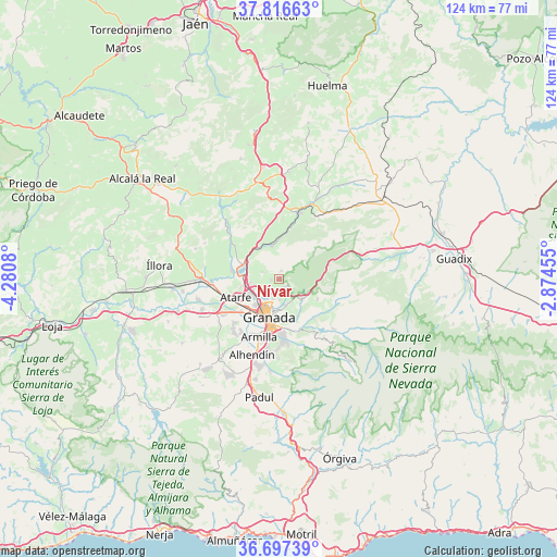
Nívar GPS coordinates[2]
37° 15' 32.724" North, 3° 34' 39.648" West
| Map corner | latitude | longitude |
|---|---|---|
| Upper-left | 37.81663°, | -4.2808° |
| Center: | 37.25909°, | -3.57768° |
| Lower-right: | 36.69739°, | -2.87455° |
| Map W x H: | 124.4×124.4 km | = 77.3×77.3mi |
| max Lat: | 43.74134° ⇑93.3% North |
| Nívar: | 37.25909° |
| min Lat: | ⇓6.7% South 27.64134° |
| min Long | Nívar | max Long |
| -18.00367° | -3.57768° | 4.2899° |
| W 46.7%⇐ | ⇒53.3% E |
Elevation
Elevation of Nívar is 1034 m = 3392 ft, and this is 436 m = 1430 ft above average elevation for this country.
| Max E: |
1682 m = 5518 ft | 9.8% |
| Nívar | 1034 m 3392 ft | |
| Avg. | 598 m = 1962 ft | |
Min E: |
0 m = 0 ft | 90.2% |
See also: Spain elevation on elevation.city.
Geographical zone
Nívar is located in North temperate zone (between Tropic of Cancer and the Arctic Circle). Distance of this Northern Tropic circle is 1536.9 km =955 mi to South.| Distance of | km | miles | from Nívar |
|---|---|---|---|
| North Pole | 5864.2 | 3643.8 | to North |
| Arctic Circle | 3258.4 | 2024.7 | to North |
| Tropic Cancer | 1536.9 | 955 | to South |
| Equator | 4142.8 | 2574.2 | to South |


Nearby cities:
15 places around Nívar: (largest is in red/bold)
• Albolote
7.5 km =4.7 mi,  245°
245°
• Alfacar
2.6 km =1.6 mi,  160°
160°
• Atarfe
10.4 km =6.5 mi, 248°
• Beas de Granada
9.7 km =6 mi,  118°
118°
• Calicasas
3.4 km =2.1 mi,  293°
293°
• Cenes de la Vega
11.6 km =7.2 mi, 161°
• Deifontes
7.6 km =4.7 mi,  347°
347°
• Granada
8.3 km =5.2 mi,  198°
198°
• Güevéjar
1.7 km =1.1 mi,  264°
264°
• Huétor Santillán
6.9 km =4.3 mi,  128°
128°
• Jun
4.5 km =2.8 mi, 198°
• Maracena
7.6 km =4.7 mi,  221°
221°
• Peligros
5.4 km =3.4 mi,  236°
236°
• Pulianas
4.8 km =3 mi,  214°
214°
• Víznar
3.7 km =2.3 mi,  145°
145°
Sources, notices
• [Note1] Compared only with cities in Spain existing in our database
• [Src1] Map data: © OpenStreetMap contributors (CC-BY-SA)
• [Src2] Other city data from geonames.org with taken over terms of usage.
• [Src3] Geographical zone / Annual Mean Temperature by Robert A. Rohde @ Wikipedia
