Jabugo geodata
Jabugo (Andalusia) is a seat of a third-order administrative division; located in Spain in Europe/Madrid (GMT+2) time zone. In our database, there are 6762 cities with bigger population. Compared to other cities in Spain, 89% of cities are located further ↑North; 93.1% of cities are located further →East and 50.1% of cities have lower elevation than Jabugo. Note1


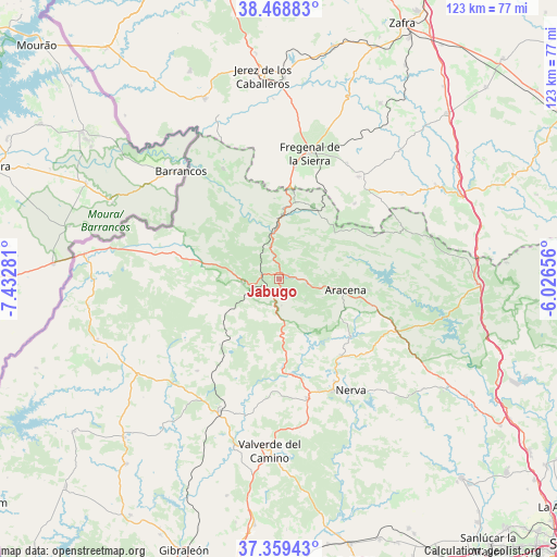
Jabugo GPS coordinates[2]
37° 54' 58.392" North, 6° 43' 46.848" West
| Map corner | latitude | longitude |
|---|---|---|
| Upper-left | 38.46883°, | -7.43281° |
| Center: | 37.91622°, | -6.72968° |
| Lower-right: | 37.35943°, | -6.02656° |
| Map W x H: | 123.4×123.4 km | = 76.7×76.7mi |
| max Lat: | 43.74134° ⇑89% North |
| Jabugo: | 37.91622° |
| min Lat: | ⇓11% South 27.64134° |
| min Long | Jabugo | max Long |
| -18.00367° | -6.72968° | 4.2899° |
| W 6.9%⇐ | ⇒93.1% E |
Elevation
Elevation of Jabugo is 658 m = 2159 ft, and this is 60 m = 197 ft above average elevation for this country.
| Max E: |
1682 m = 5518 ft | 49.9% |
| Jabugo | 658 m 2159 ft | |
| Avg. | 598 m = 1962 ft | |
Min E: |
0 m = 0 ft | 50.1% |
See also: Spain elevation on elevation.city.
Geographical zone
Jabugo is located in North temperate zone (between Tropic of Cancer and the Arctic Circle). Distance of this Northern Tropic circle is 1610 km =1000.4 mi to South.| Distance of | km | miles | from Jabugo |
|---|---|---|---|
| North Pole | 5791.2 | 3598.5 | to North |
| Arctic Circle | 3185.3 | 1979.3 | to North |
| Tropic Cancer | 1610 | 1000.4 | to South |
| Equator | 4215.9 | 2619.6 | to South |


Nearby cities:
15 places around Jabugo: (largest is in red/bold)
• Alájar
7.3 km =4.5 mi,  129°
129°
• Aracena
15 km =9.3 mi,  99°
99°
• Aroche
20.2 km =12.6 mi,  278°
278°
• Campofrío
21.6 km =13.4 mi,  140°
140°
• Cañaveral de León
21.8 km =13.5 mi,  59°
59°
• Corteconcepción
20.2 km =12.6 mi, 95°
• Cortegana
8 km =5 mi,  265°
265°
• Cortelazor
9.5 km =5.9 mi,  76°
76°
• Cumbres Mayores
17.8 km =11.1 mi,  24°
24°
• Fuenteheridos
6.1 km =3.8 mi, 101°
• Galaroza
2.4 km =1.5 mi,  54°
54°
• Hinojales
15.9 km =9.9 mi, 54°
• Linares de la Sierra
10.2 km =6.3 mi,  113°
113°
• Santa Ana la Real
6 km =3.7 mi,  175°
175°
• Valdelarco
5.5 km =3.4 mi, 49°
Sources, notices
• [Note1] Compared only with cities in Spain existing in our database
• [Src1] Map data: © OpenStreetMap contributors (CC-BY-SA)
• [Src2] Other city data from geonames.org with taken over terms of usage.
• [Src3] Geographical zone / Annual Mean Temperature by Robert A. Rohde @ Wikipedia
