Montemolín geodata
Montemolín (Extremadura) is a populated place; located in Spain in Europe/Madrid (GMT+2) time zone. With population of 1,578 people, there are 2404 cities with bigger population in this country. Compared to other cities in Spain, 87.5% of cities are located further ↑North; 88.6% of cities are located further →East and 50.2% of cities have lower elevation than Montemolín. Note1
Administrative division(s):
- Level 1: Extremadura
- Level 2: Provincia de Badajoz
- Level 3: Fuente de Cantos


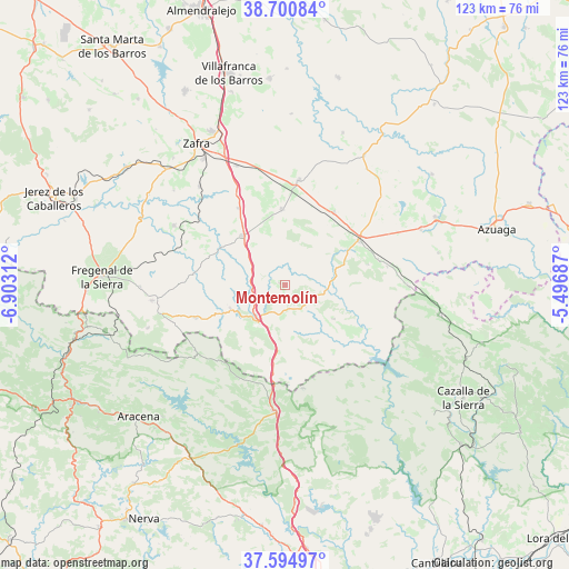
Montemolín GPS coordinates[2]
38° 9' 0" North, 6° 12' 0" West
| Map corner | latitude | longitude |
|---|---|---|
| Upper-left | 38.70084°, | -6.90312° |
| Center: | 38.15°, | -6.2° |
| Lower-right: | 37.59497°, | -5.49687° |
| Map W x H: | 123×123 km | = 76.4×76.4mi |
| max Lat: | 43.74134° ⇑87.5% North |
| Montemolín: | 38.15° |
| min Lat: | ⇓12.5% South 27.64134° |
| min Long | Montemolín | max Long |
| -18.00367° | -6.2° | 4.2899° |
| W 11.4%⇐ | ⇒88.6% E |
Elevation
Elevation of Montemolín is 660 m = 2165 ft, and this is 62 m = 203 ft above average elevation for this country.
| Max E: |
1682 m = 5518 ft | 49.8% |
| Montemolín | 660 m 2165 ft | |
| Avg. | 598 m = 1962 ft | |
Min E: |
0 m = 0 ft | 50.2% |
See also: Spain elevation on elevation.city.
Geographical zone
Montemolín is located in North temperate zone (between Tropic of Cancer and the Arctic Circle). Distance of this Northern Tropic circle is 1636 km =1016.6 mi to South.| Distance of | km | miles | from Montemolín |
|---|---|---|---|
| North Pole | 5765.2 | 3582.3 | to North |
| Arctic Circle | 3159.3 | 1963.1 | to North |
| Tropic Cancer | 1636 | 1016.6 | to South |
| Equator | 4241.9 | 2635.8 | to South |


Nearby cities:
15 places around Montemolín: (largest is in red/bold)
• Arroyomolinos de León
24.1 km =15 mi,  231°
231°
• Bienvenida
16.7 km =10.4 mi,  0°
0°
• Cabeza la Vaca
20.4 km =12.7 mi,  248°
248°
• Cala
22.8 km =14.2 mi,  206°
206°
• Calera de León
12.9 km =8 mi,  244°
244°
• Calzadilla de Los Barros
19.5 km =12.1 mi,  328°
328°
• Casas de Reina
21.1 km =13.1 mi,  74°
74°
• Fuente de Cantos
14.1 km =8.8 mi,  321°
321°
• Llerena
18.5 km =11.5 mi,  59°
59°
• Monesterio
9.4 km =5.8 mi,  218°
218°
• Puebla del Maestre
12.6 km =7.8 mi,  125°
125°
• Reina
22.2 km =13.8 mi,  80°
80°
• Trasierra
17.9 km =11.1 mi, 78°
• Usagre
22.4 km =13.9 mi,  7°
7°
• Villagarcía de la Torre
19.5 km =12.1 mi,  31°
31°
Sources, notices
• [Note1] Compared only with cities in Spain existing in our database
• [Src1] Map data: © OpenStreetMap contributors (CC-BY-SA)
• [Src2] Other city data from geonames.org with taken over terms of usage.
• [Src3] Geographical zone / Annual Mean Temperature by Robert A. Rohde @ Wikipedia
