Huerta de la Obispalía geodata
Huerta de la Obispalía (Castille-La Mancha) is a seat of a third-order administrative division; located in Spain in Europe/Madrid (GMT+2) time zone. With population of 160 people, there are 5341 cities with bigger population in this country. Compared to other cities in Spain, 70.3% of cities are located further ↑North; 61.2% of cities are located further ←West and 81.3% of cities have lower elevation than Huerta de la Obispalía. Note1
Administrative division(s):
- Level 1: Castille-La Mancha
- Level 2: Provincia de Cuenca
- Level 3: Huerta de la Obispalía
Current local time in Huerta de la Obispalía:
10:43 PM, ThursdayDifference from your time zone: hours


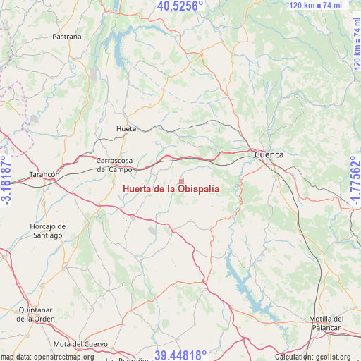
Huerta de la Obispalía GPS coordinates[2]
39° 59' 20.436" North, 2° 28' 43.5" West
| Map corner | latitude | longitude |
|---|---|---|
| Upper-left | 40.5256°, | -3.18187° |
| Center: | 39.98901°, | -2.47875° |
| Lower-right: | 39.44818°, | -1.77562° |
| Map W x H: | 119.8×119.8 km | = 74.4×74.4mi |
| max Lat: | 43.74134° ⇑70.3% North |
| Huerta de la Obispalía: | 39.98901° |
| min Lat: | ⇓29.7% South 27.64134° |
| min Long | Huerta de la Ob | max Long |
| -18.00367° | -2.47875° | 4.2899° |
| W 61.2%⇐ | ⇒38.8% E |
Elevation
Elevation of Huerta de la Obispalía is 910 m = 2986 ft, and this is 312 m = 1024 ft above average elevation for this country.
| Max E: |
1682 m = 5518 ft | 18.7% |
| Huerta de la Obispalía | 910 m 2986 ft | |
| Avg. | 598 m = 1962 ft | |
Min E: |
0 m = 0 ft | 81.3% |
See also: Spain elevation on elevation.city.
Geographical zone
Huerta de la Obispalía is located in North temperate zone (between Tropic of Cancer and the Arctic Circle). Distance of this Northern Tropic circle is 1840.4 km =1143.6 mi to South.| Distance of | km | miles | from Huerta de la Obispalía |
|---|---|---|---|
| North Pole | 5560.7 | 3455.3 | to North |
| Arctic Circle | 2954.8 | 1836 | to North |
| Tropic Cancer | 1840.4 | 1143.6 | to South |
| Equator | 4446.4 | 2762.9 | to South |


Nearby cities:
15 places around Huerta de la Obispalía: (largest is in red/bold)
• Altarejos
13.4 km =8.3 mi,  129°
129°
• Belmontejo
21.8 km =13.5 mi,  148°
148°
• Cervera del Llano
23.4 km =14.5 mi,  167°
167°
• Fresneda de Altarejos
15.6 km =9.7 mi,  116°
116°
• Montalbo
20.3 km =12.6 mi,  233°
233°
• Mota de Altarejos
18.7 km =11.6 mi, 129°
• Palomares del Campo
11.2 km =7 mi,  245°
245°
• Pineda de Gigüela
12.1 km =7.5 mi,  332°
332°
• San Lorenzo de la Parrilla
18.3 km =11.4 mi, 146°
• Torrejoncillo del Rey
8.2 km =5.1 mi,  285°
285°
• Villar de Olalla
24.3 km =15.1 mi,  83°
83°
• Villarejo de la Peñuela
12.4 km =7.7 mi,  28°
28°
• Villarejo-Periesteban
13.4 km =8.3 mi, 166°
• Villares del Saz
16.6 km =10.3 mi,  187°
187°
• Zafra de Záncara
12.7 km =7.9 mi,  212°
212°
Sources, notices
• [Note1] Compared only with cities in Spain existing in our database
• [Src1] Map data: © OpenStreetMap contributors (CC-BY-SA)
• [Src2] Other city data from geonames.org with taken over terms of usage.
• [Src3] Geographical zone / Annual Mean Temperature by Robert A. Rohde @ Wikipedia
