Altarejos geodata
Altarejos (Castille-La Mancha) is a seat of a third-order administrative division; located in Spain in Europe/Madrid (GMT+2) time zone. With population of 340 people, there are 4347 cities with bigger population in this country. Compared to other cities in Spain, 71.5% of cities are located further ↑North; 62.8% of cities are located further ←West and 78.4% of cities have lower elevation than Altarejos. Note1
Administrative division(s):
- Level 1: Castille-La Mancha
- Level 2: Provincia de Cuenca
- Level 3: Altarejos


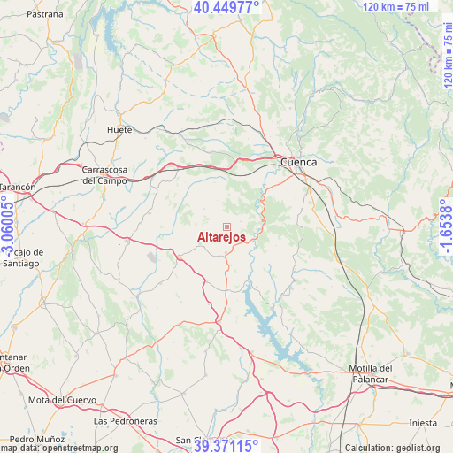
Altarejos GPS coordinates[2]
39° 54' 45.288" North, 2° 21' 24.912" West
| Map corner | latitude | longitude |
|---|---|---|
| Upper-left | 40.44977°, | -3.06005° |
| Center: | 39.91258°, | -2.35692° |
| Lower-right: | 39.37115°, | -1.6538° |
| Map W x H: | 119.9×119.9 km | = 74.5×74.5mi |
| max Lat: | 43.74134° ⇑71.5% North |
| Altarejos: | 39.91258° |
| min Lat: | ⇓28.5% South 27.64134° |
| min Long | Altarejos | max Long |
| -18.00367° | -2.35692° | 4.2899° |
| W 62.8%⇐ | ⇒37.2% E |
Elevation
Elevation of Altarejos is 883 m = 2897 ft, and this is 285 m = 935 ft above average elevation for this country.
| Max E: |
1682 m = 5518 ft | 21.6% |
| Altarejos | 883 m 2897 ft | |
| Avg. | 598 m = 1962 ft | |
Min E: |
0 m = 0 ft | 78.4% |
See also: Spain elevation on elevation.city.
Geographical zone
Altarejos is located in North temperate zone (between Tropic of Cancer and the Arctic Circle). Distance of this Northern Tropic circle is 1831.9 km =1138.3 mi to South.| Distance of | km | miles | from Altarejos |
|---|---|---|---|
| North Pole | 5569.2 | 3460.5 | to North |
| Arctic Circle | 2963.3 | 1841.3 | to North |
| Tropic Cancer | 1831.9 | 1138.3 | to South |
| Equator | 4437.9 | 2757.6 | to South |


Nearby cities:
15 places around Altarejos: (largest is in red/bold)
• Albaladejo del Cuende
16 km =9.9 mi,  137°
137°
• Belmontejo
10.1 km =6.3 mi,  174°
174°
• Cervera del Llano
15.4 km =9.6 mi,  200°
200°
• Fresneda de Altarejos
3.9 km =2.4 mi,  67°
67°
• Huerta de la Obispalía
13.4 km =8.3 mi,  309°
309°
• Mota de Altarejos
5.3 km =3.3 mi,  130°
130°
• Olivares de Júcar
16.9 km =10.5 mi,  179°
179°
• Palomares del Campo
20.9 km =13 mi,  280°
280°
• San Lorenzo de la Parrilla
6.8 km =4.2 mi, 182°
• Villar de Olalla
17.8 km =11.1 mi,  50°
50°
• Villarejo de la Peñuela
20 km =12.4 mi,  346°
346°
• Villarejo-Periesteban
8.5 km =5.3 mi,  238°
238°
• Villares del Saz
14.9 km =9.3 mi, 237°
• Villaverde y Pasaconsol
17.6 km =10.9 mi,  153°
153°
• Zafra de Záncara
17.3 km =10.7 mi,  262°
262°
Sources, notices
• [Note1] Compared only with cities in Spain existing in our database
• [Src1] Map data: © OpenStreetMap contributors (CC-BY-SA)
• [Src2] Other city data from geonames.org with taken over terms of usage.
• [Src3] Geographical zone / Annual Mean Temperature by Robert A. Rohde @ Wikipedia
