Villar de Olalla geodata
Villar de Olalla (Castille-La Mancha) is a seat of a third-order administrative division; located in Spain in Europe/Madrid (GMT+2) time zone. With population of 1,028 people, there are 2900 cities with bigger population in this country. Compared to other cities in Spain, 70.1% of cities are located further ↑North; 64.8% of cities are located further ←West and 81.4% of cities have lower elevation than Villar de Olalla. Note1
Administrative division(s):
- Level 1: Castille-La Mancha
- Level 2: Provincia de Cuenca
- Level 3: Villar de Olalla


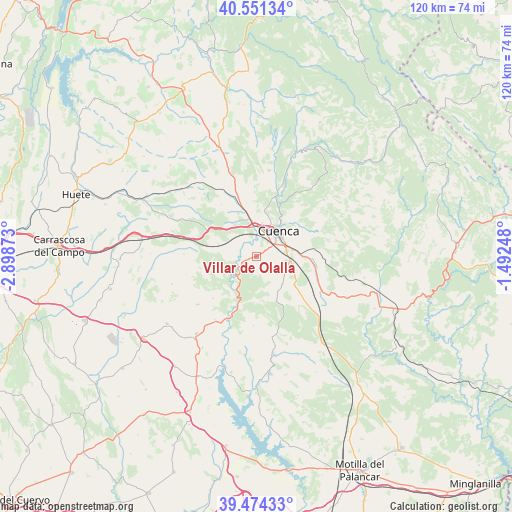
Villar de Olalla GPS coordinates[2]
40° 0' 53.856" North, 2° 11' 44.196" West
| Map corner | latitude | longitude |
|---|---|---|
| Upper-left | 40.55134°, | -2.89873° |
| Center: | 40.01496°, | -2.19561° |
| Lower-right: | 39.47433°, | -1.49248° |
| Map W x H: | 119.8×119.8 km | = 74.4×74.4mi |
| max Lat: | 43.74134° ⇑70.1% North |
| Villar de Olalla: | 40.01496° |
| min Lat: | ⇓29.9% South 27.64134° |
| min Long | Villar de Olall | max Long |
| -18.00367° | -2.19561° | 4.2899° |
| W 64.8%⇐ | ⇒35.2% E |
Elevation
Elevation of Villar de Olalla is 911 m = 2989 ft, and this is 313 m = 1027 ft above average elevation for this country.
| Max E: |
1682 m = 5518 ft | 18.6% |
| Villar de Olalla | 911 m 2989 ft | |
| Avg. | 598 m = 1962 ft | |
Min E: |
0 m = 0 ft | 81.4% |
See also: Spain elevation on elevation.city.
Geographical zone
Villar de Olalla is located in North temperate zone (between Tropic of Cancer and the Arctic Circle). Distance of this Northern Tropic circle is 1843.3 km =1145.4 mi to South.| Distance of | km | miles | from Villar de Olalla |
|---|---|---|---|
| North Pole | 5557.8 | 3453.5 | to North |
| Arctic Circle | 2951.9 | 1834.2 | to North |
| Tropic Cancer | 1843.3 | 1145.4 | to South |
| Equator | 4449.2 | 2764.6 | to South |


Nearby cities:
15 places around Villar de Olalla: (largest is in red/bold)
• Albaladejo del Cuende
23.3 km =14.5 mi,  187°
187°
• Altarejos
17.8 km =11.1 mi,  230°
230°
• Bascuñana de San Pedro
22.2 km =13.8 mi,  352°
352°
• Belmontejo
24.9 km =15.5 mi,  210°
210°
• Cañada del Hoyo
25.7 km =16 mi,  102°
102°
• Chillarón de Cuenca
10.3 km =6.4 mi, 347°
• Cuenca
7.8 km =4.8 mi,  42°
42°
• Fresneda de Altarejos
14.2 km =8.8 mi, 225°
• Fuentes
16.2 km =10.1 mi,  109°
109°
• Huerta de la Obispalía
24.3 km =15.1 mi,  263°
263°
• Mariana
17.4 km =10.8 mi,  13°
13°
• Mota de Altarejos
17.7 km =11 mi, 213°
• Olmeda del Rey
25.7 km =16 mi,  158°
158°
• San Lorenzo de la Parrilla
23 km =14.3 mi,  217°
217°
• Villarejo de la Peñuela
19.9 km =12.4 mi,  293°
293°
Sources, notices
• [Note1] Compared only with cities in Spain existing in our database
• [Src1] Map data: © OpenStreetMap contributors (CC-BY-SA)
• [Src2] Other city data from geonames.org with taken over terms of usage.
• [Src3] Geographical zone / Annual Mean Temperature by Robert A. Rohde @ Wikipedia
