Higuera geodata
Higuera (Extremadura) is a seat of a third-order administrative division; located in Spain in Europe/Madrid (GMT+2) time zone. With population of 97 people, there are 5975 cities with bigger population in this country. Compared to other cities in Spain, 73.9% of cities are located further ↑North; 81.2% of cities are located further →East and 63.7% of cities have higher elevation than Higuera. Note1


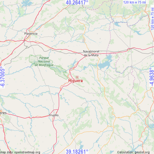
Higuera GPS coordinates[2]
39° 43' 31.836" North, 5° 40' 0.912" West
| Map corner | latitude | longitude |
|---|---|---|
| Upper-left | 40.26417°, | -6.37005° |
| Center: | 39.72551°, | -5.66692° |
| Lower-right: | 39.18261°, | -4.9638° |
| Map W x H: | 120.3×120.3 km | = 74.8×74.8mi |
| max Lat: | 43.74134° ⇑73.9% North |
| Higuera: | 39.72551° |
| min Lat: | ⇓26.1% South 27.64134° |
| min Long | Higuera | max Long |
| -18.00367° | -5.66692° | 4.2899° |
| W 18.8%⇐ | ⇒81.2% E |
Elevation
Elevation of Higuera is 477 m = 1565 ft, and this is 121 m = 397 ft below average elevation for this country.
| Max E: |
1682 m = 5518 ft | 63.7% |
| Avg. | 598 m = 1962 ft | |
| Higuera | 477 m = 1565 ft | |
Min E: |
0 m = 0 ft | 36.3% |
See also: Spain elevation on elevation.city.
Geographical zone
Higuera is located in North temperate zone (between Tropic of Cancer and the Arctic Circle). Distance of this Northern Tropic circle is 1811.1 km =1125.4 mi to South.| Distance of | km | miles | from Higuera |
|---|---|---|---|
| North Pole | 5590 | 3473.5 | to North |
| Arctic Circle | 2984.1 | 1854.2 | to North |
| Tropic Cancer | 1811.1 | 1125.4 | to South |
| Equator | 4417.1 | 2744.7 | to South |


Nearby cities:
15 places around Higuera: (largest is in red/bold)
• Almaraz
9.9 km =6.2 mi,  355°
355°
• Belvis de Monroy
11.5 km =7.1 mi,  25°
25°
• Bohonal de Ibor
16.9 km =10.5 mi,  67°
67°
• Campillo de Deleitosa
8.3 km =5.2 mi,  107°
107°
• Casas de Miravete
6.6 km =4.1 mi,  271°
271°
• Deleitosa
9.3 km =5.8 mi,  168°
168°
• Fresnedoso de Ibor
14.3 km =8.9 mi, 108°
• Jaraicejo
14.1 km =8.8 mi,  242°
242°
• Mesas de Ibor
10.8 km =6.7 mi, 71°
• Millanes
15.6 km =9.7 mi, 28°
• Romangordo
3.4 km =2.1 mi,  302°
302°
• Saucedilla
14.2 km =8.8 mi, 356°
• Serrejón
15.5 km =9.6 mi,  311°
311°
• Valdecañas de Tajo
5.5 km =3.4 mi,  47°
47°
• Valdehúncar
17.4 km =10.8 mi,  44°
44°
Sources, notices
• [Note1] Compared only with cities in Spain existing in our database
• [Src1] Map data: © OpenStreetMap contributors (CC-BY-SA)
• [Src2] Other city data from geonames.org with taken over terms of usage.
• [Src3] Geographical zone / Annual Mean Temperature by Robert A. Rohde @ Wikipedia
