Fuente de Pedro Naharro geodata
Fuente de Pedro Naharro (Castille-La Mancha) is a seat of a third-order administrative division; located in Spain in Europe/Madrid (GMT+2) time zone. With population of 1,280 people, there are 2659 cities with bigger population in this country. Compared to other cities in Spain, 71.3% of cities are located further ↑North; 54.2% of cities are located further ←West and 64.4% of cities have lower elevation than Fuente de Pedro Naharro. Note1
Administrative division(s):
- Level 1: Castille-La Mancha
- Level 2: Provincia de Cuenca
- Level 3: Fuente de Pedro Naharro
Current local time in Fuente de Pedro Naharro:
10:48 PM, ThursdayDifference from your time zone: hours


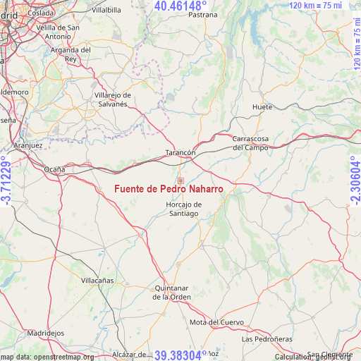
Fuente de Pedro Naharro GPS coordinates[2]
39° 55' 27.768" North, 3° 0' 32.976" West
| Map corner | latitude | longitude |
|---|---|---|
| Upper-left | 40.46148°, | -3.71229° |
| Center: | 39.92438°, | -3.00916° |
| Lower-right: | 39.38304°, | -2.30604° |
| Map W x H: | 119.9×119.9 km | = 74.5×74.5mi |
| max Lat: | 43.74134° ⇑71.3% North |
| Fuente de Pedro Naharro: | 39.92438° |
| min Lat: | ⇓28.7% South 27.64134° |
| min Long | Fuente de Pedro | max Long |
| -18.00367° | -3.00916° | 4.2899° |
| W 54.2%⇐ | ⇒45.8% E |
Elevation
Elevation of Fuente de Pedro Naharro is 774 m = 2539 ft, and this is 176 m = 577 ft above average elevation for this country.
| Max E: |
1682 m = 5518 ft | 35.6% |
| Fuente de Pedro Naharro | 774 m 2539 ft | |
| Avg. | 598 m = 1962 ft | |
Min E: |
0 m = 0 ft | 64.4% |
See also: Spain elevation on elevation.city.
Geographical zone
Fuente de Pedro Naharro is located in North temperate zone (between Tropic of Cancer and the Arctic Circle). Distance of this Northern Tropic circle is 1833.3 km =1139.2 mi to South.| Distance of | km | miles | from Fuente de Pedro Naharro |
|---|---|---|---|
| North Pole | 5567.9 | 3459.7 | to North |
| Arctic Circle | 2962 | 1840.5 | to North |
| Tropic Cancer | 1833.3 | 1139.2 | to South |
| Equator | 4439.2 | 2758.4 | to South |


Nearby cities:
15 places around Fuente de Pedro Naharro: (largest is in red/bold)
• Belinchón
14.1 km =8.8 mi,  343°
343°
• Cabezamesada
14.4 km =8.9 mi,  213°
213°
• Horcajo de Santiago
9.2 km =5.7 mi,  173°
173°
• Huelves
16.9 km =10.5 mi,  38°
38°
• Paredes
20.5 km =12.7 mi, 40°
• Pozorrubio
13 km =8.1 mi,  156°
156°
• Rozalén del Monte
18.9 km =11.7 mi,  66°
66°
• Saelices
17.4 km =10.8 mi,  91°
91°
• Santa Cruz de la Zarza
16.5 km =10.3 mi,  292°
292°
• Tarancón
9.4 km =5.8 mi,  0°
0°
• Torrubia del Campo
5.1 km =3.2 mi,  126°
126°
• Tribaldos
10.9 km =6.8 mi,  60°
60°
• Uclés
14 km =8.7 mi, 64°
• Villarrubio
10.1 km =6.3 mi,  76°
76°
• Zarza de Tajo
14.4 km =8.9 mi,  314°
314°
Sources, notices
• [Note1] Compared only with cities in Spain existing in our database
• [Src1] Map data: © OpenStreetMap contributors (CC-BY-SA)
• [Src2] Other city data from geonames.org with taken over terms of usage.
• [Src3] Geographical zone / Annual Mean Temperature by Robert A. Rohde @ Wikipedia
