Cabezamesada geodata
Cabezamesada (Castille-La Mancha) is a seat of a third-order administrative division; located in Spain in Europe/Madrid (GMT+2) time zone. With population of 500 people, there are 3886 cities with bigger population in this country. Compared to other cities in Spain, 72.7% of cities are located further ↑North; 52.7% of cities are located further ←West and 58.7% of cities have lower elevation than Cabezamesada. Note1
Administrative division(s):
- Level 1: Castille-La Mancha
- Level 2: Province of Toledo
- Level 3: Cabezamesada


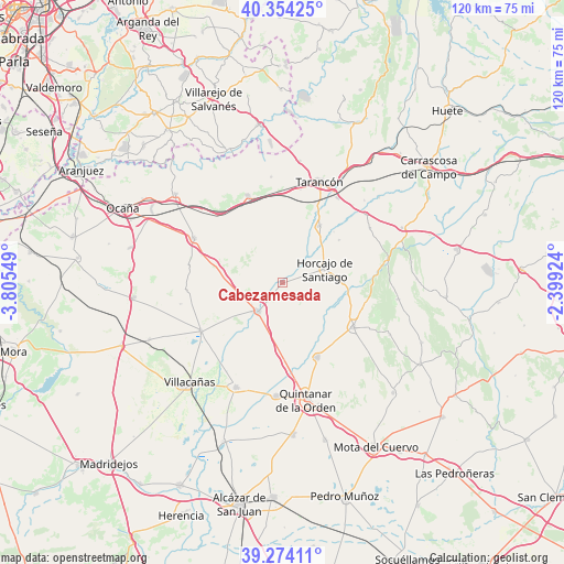
Cabezamesada GPS coordinates[2]
39° 48' 58.68" North, 3° 6' 8.496" West
| Map corner | latitude | longitude |
|---|---|---|
| Upper-left | 40.35425°, | -3.80549° |
| Center: | 39.8163°, | -3.10236° |
| Lower-right: | 39.27411°, | -2.39924° |
| Map W x H: | 120.1×120.1 km | = 74.6×74.6mi |
| max Lat: | 43.74134° ⇑72.7% North |
| Cabezamesada: | 39.8163° |
| min Lat: | ⇓27.3% South 27.64134° |
| min Long | Cabezamesada | max Long |
| -18.00367° | -3.10236° | 4.2899° |
| W 52.7%⇐ | ⇒47.3% E |
Elevation
Elevation of Cabezamesada is 735 m = 2411 ft, and this is 137 m = 449 ft above average elevation for this country.
| Max E: |
1682 m = 5518 ft | 41.3% |
| Cabezamesada | 735 m 2411 ft | |
| Avg. | 598 m = 1962 ft | |
Min E: |
0 m = 0 ft | 58.7% |
See also: Spain elevation on elevation.city.
Geographical zone
Cabezamesada is located in North temperate zone (between Tropic of Cancer and the Arctic Circle). Distance of this Northern Tropic circle is 1821.2 km =1131.6 mi to South.| Distance of | km | miles | from Cabezamesada |
|---|---|---|---|
| North Pole | 5579.9 | 3467.2 | to North |
| Arctic Circle | 2974 | 1848 | to North |
| Tropic Cancer | 1821.2 | 1131.6 | to South |
| Equator | 4427.2 | 2750.9 | to South |


Nearby cities:
15 places around Cabezamesada: (largest is in red/bold)
• Corral de Almaguer
8.2 km =5.1 mi,  220°
220°
• Fuente de Pedro Naharro
14.4 km =8.9 mi,  33°
33°
• Horcajo de Santiago
9.4 km =5.8 mi,  72°
72°
• La Puebla de Almoradiel
24.2 km =15 mi,  183°
183°
• Lillo
20.3 km =12.6 mi,  239°
239°
• Pozorrubio
13.1 km =8.1 mi,  89°
89°
• Santa Cruz de la Zarza
19.7 km =12.2 mi,  338°
338°
• Tarancón
22.9 km =14.2 mi,  20°
20°
• Torrubia del Campo
15 km =9.3 mi,  53°
53°
• Villa de Don Fadrique
24.5 km =15.2 mi,  204°
204°
• Villamayor de Santiago
18 km =11.2 mi,  121°
121°
• Villanueva de Alcardete
17.6 km =10.9 mi,  154°
154°
• Villarrubio
22.8 km =14.2 mi, 51°
• Villatobas
21.2 km =13.2 mi,  296°
296°
• Zarza de Tajo
22.3 km =13.9 mi,  354°
354°
Sources, notices
• [Note1] Compared only with cities in Spain existing in our database
• [Src1] Map data: © OpenStreetMap contributors (CC-BY-SA)
• [Src2] Other city data from geonames.org with taken over terms of usage.
• [Src3] Geographical zone / Annual Mean Temperature by Robert A. Rohde @ Wikipedia
