Fuente del Arco geodata
Fuente del Arco (Extremadura) is a populated place; located in Spain in Europe/Madrid (GMT+2) time zone. With population of 732 people, there are 3342 cities with bigger population in this country. Compared to other cities in Spain, 87.5% of cities are located further ↑North; 84.7% of cities are located further →East and 59.5% of cities have lower elevation than Fuente del Arco. Note1
Administrative division(s):
- Level 1: Extremadura
- Level 2: Provincia de Badajoz
- Level 3: Casas de Reina


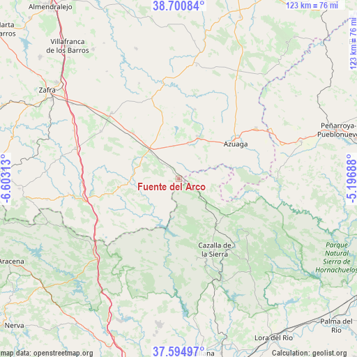
Fuente del Arco GPS coordinates[2]
38° 9' 0" North, 5° 54' 0" West
| Map corner | latitude | longitude |
|---|---|---|
| Upper-left | 38.70084°, | -6.60313° |
| Center: | 38.15°, | -5.9° |
| Lower-right: | 37.59497°, | -5.19688° |
| Map W x H: | 123×123 km | = 76.4×76.4mi |
| max Lat: | 43.74134° ⇑87.5% North |
| Fuente del Arco: | 38.15° |
| min Lat: | ⇓12.5% South 27.64134° |
| min Long | Fuente del Arco | max Long |
| -18.00367° | -5.9° | 4.2899° |
| W 15.3%⇐ | ⇒84.7% E |
Elevation
Elevation of Fuente del Arco is 741 m = 2431 ft, and this is 143 m = 469 ft above average elevation for this country.
| Max E: |
1682 m = 5518 ft | 40.5% |
| Fuente del Arco | 741 m 2431 ft | |
| Avg. | 598 m = 1962 ft | |
Min E: |
0 m = 0 ft | 59.5% |
See also: Spain elevation on elevation.city.
Geographical zone
Fuente del Arco is located in North temperate zone (between Tropic of Cancer and the Arctic Circle). Distance of this Northern Tropic circle is 1636 km =1016.6 mi to South.| Distance of | km | miles | from Fuente del Arco |
|---|---|---|---|
| North Pole | 5765.2 | 3582.3 | to North |
| Arctic Circle | 3159.3 | 1963.1 | to North |
| Tropic Cancer | 1636 | 1016.6 | to South |
| Equator | 4241.9 | 2635.8 | to South |


Nearby cities:
15 places around Fuente del Arco: (largest is in red/bold)
• Ahillones
13.7 km =8.5 mi,  18°
18°
• Alanís
20.6 km =12.8 mi,  128°
128°
• Azuaga
22.9 km =14.2 mi,  55°
55°
• Berlanga
16.5 km =10.3 mi,  26°
26°
• Casas de Reina
8.1 km =5 mi,  313°
313°
• Guadalcanal
9.2 km =5.7 mi, 127°
• Llerena
13.8 km =8.6 mi, 312°
• Maguilla
24.8 km =15.4 mi,  13°
13°
• Malcocinado
19.3 km =12 mi,  101°
101°
• Montemolín
26.2 km =16.3 mi,  270°
270°
• Puebla del Maestre
17.7 km =11 mi,  245°
245°
• Reina
5.7 km =3.5 mi, 310°
• Trasierra
9.5 km =5.9 mi,  292°
292°
• Valverde de Llerena
10.4 km =6.5 mi,  44°
44°
• Villagarcía de la Torre
23.1 km =14.4 mi,  316°
316°
Sources, notices
• [Note1] Compared only with cities in Spain existing in our database
• [Src1] Map data: © OpenStreetMap contributors (CC-BY-SA)
• [Src2] Other city data from geonames.org with taken over terms of usage.
• [Src3] Geographical zone / Annual Mean Temperature by Robert A. Rohde @ Wikipedia
