Ahillones geodata
Ahillones (Extremadura) is a seat of a third-order administrative division; located in Spain in Europe/Madrid (GMT+2) time zone. With population of 1,101 people, there are 2822 cities with bigger population in this country. Compared to other cities in Spain, 86.9% of cities are located further ↑North; 83.9% of cities are located further →East and 55.1% of cities have higher elevation than Ahillones. Note1


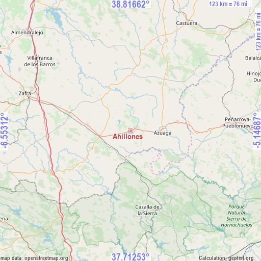
Ahillones GPS coordinates[2]
38° 16' 0.012" North, 5° 51' 0" West
| Map corner | latitude | longitude |
|---|---|---|
| Upper-left | 38.81662°, | -6.55312° |
| Center: | 38.26667°, | -5.85° |
| Lower-right: | 37.71253°, | -5.14687° |
| Map W x H: | 122.8×122.8 km | = 76.3×76.3mi |
| max Lat: | 43.74134° ⇑86.9% North |
| Ahillones: | 38.26667° |
| min Lat: | ⇓13.1% South 27.64134° |
| min Long | Ahillones | max Long |
| -18.00367° | -5.85° | 4.2899° |
| W 16.1%⇐ | ⇒83.9% E |
Elevation
Elevation of Ahillones is 594 m = 1949 ft, and this is 4 m = 13 ft below average elevation for this country.
| Max E: |
1682 m = 5518 ft | 55.1% |
| Avg. | 598 m = 1962 ft | |
| Ahillones | 594 m = 1949 ft | |
Min E: |
0 m = 0 ft | 44.9% |
See also: Spain elevation on elevation.city.
Geographical zone
Ahillones is located in North temperate zone (between Tropic of Cancer and the Arctic Circle). Distance of this Northern Tropic circle is 1648.9 km =1024.6 mi to South.| Distance of | km | miles | from Ahillones |
|---|---|---|---|
| North Pole | 5752.2 | 3574.3 | to North |
| Arctic Circle | 3146.3 | 1955 | to North |
| Tropic Cancer | 1648.9 | 1024.6 | to South |
| Equator | 4254.9 | 2643.9 | to South |


Nearby cities:
15 places around Ahillones: (largest is in red/bold)
• Azuaga
14.6 km =9.1 mi,  90°
90°
• Berlanga
3.4 km =2.1 mi,  57°
57°
• Campillo de Llerena
26.2 km =16.3 mi,  3°
3°
• Casas de Reina
12.6 km =7.8 mi,  233°
233°
• Fuente del Arco
13.7 km =8.5 mi,  198°
198°
• Granja de Torrehermosa
23.9 km =14.9 mi,  76°
76°
• Guadalcanal
18.8 km =11.7 mi,  171°
171°
• Llerena
15 km =9.3 mi,  255°
255°
• Maguilla
11.2 km =7 mi,  7°
7°
• Malcocinado
22.1 km =13.7 mi,  138°
138°
• Reina
12.7 km =7.9 mi,  223°
223°
• Trasierra
16 km =9.9 mi, 234°
• Valencia de las Torres
20.4 km =12.7 mi,  318°
318°
• Valverde de Llerena
6.3 km =3.9 mi,  152°
152°
• Villagarcía de la Torre
20.7 km =12.9 mi,  280°
280°
Sources, notices
• [Note1] Compared only with cities in Spain existing in our database
• [Src1] Map data: © OpenStreetMap contributors (CC-BY-SA)
• [Src2] Other city data from geonames.org with taken over terms of usage.
• [Src3] Geographical zone / Annual Mean Temperature by Robert A. Rohde @ Wikipedia
