El Casar geodata
El Casar (Extremadura) is a populated place; located in Spain in Europe/Madrid (GMT+2) time zone. With population of 10,031 people, there are 860 cities with bigger population in this country. Compared to other cities in Spain, 85.4% of cities are located further ↑North; 85.1% of cities are located further →East and 62% of cities have higher elevation than El Casar. Note1
Administrative division(s):
- Level 1: Extremadura
- Level 2: Provincia de Badajoz
- Level 3: Campillo de Llerena


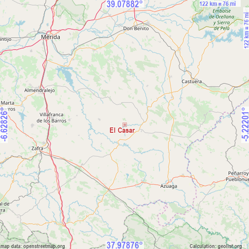
El Casar GPS coordinates[2]
38° 31' 51.204" North, 5° 55' 30.468" West
| Map corner | latitude | longitude |
|---|---|---|
| Upper-left | 39.07882°, | -6.62826° |
| Center: | 38.53089°, | -5.92513° |
| Lower-right: | 37.97876°, | -5.22201° |
| Map W x H: | 122.3×122.3 km | = 76×76mi |
| max Lat: | 43.74134° ⇑85.4% North |
| El Casar: | 38.53089° |
| min Lat: | ⇓14.6% South 27.64134° |
| min Long | El Casar | max Long |
| -18.00367° | -5.92513° | 4.2899° |
| W 14.9%⇐ | ⇒85.1% E |
Elevation
Elevation of El Casar is 499 m = 1637 ft, and this is 99 m = 325 ft below average elevation for this country.
| Max E: |
1682 m = 5518 ft | 62% |
| Avg. | 598 m = 1962 ft | |
| El Casar | 499 m = 1637 ft | |
Min E: |
0 m = 0 ft | 38% |
See also: Spain elevation on elevation.city.
Geographical zone
El Casar is located in North temperate zone (between Tropic of Cancer and the Arctic Circle). Distance of this Northern Tropic circle is 1678.3 km =1042.8 mi to South.| Distance of | km | miles | from El Casar |
|---|---|---|---|
| North Pole | 5722.8 | 3556 | to North |
| Arctic Circle | 3116.9 | 1936.8 | to North |
| Tropic Cancer | 1678.3 | 1042.8 | to South |
| Equator | 4284.2 | 2662.1 | to South |


Nearby cities:
15 places around El Casar: (largest is in red/bold)
• Berlanga
29.1 km =18.1 mi,  161°
161°
• Campillo de Llerena
8.8 km =5.5 mi,  111°
111°
• Higuera de la Serena
20.5 km =12.7 mi,  51°
51°
• Hinojosa del Valle
23.1 km =14.4 mi,  256°
256°
• Hornachos
12.7 km =7.9 mi,  281°
281°
• Llera
14.1 km =8.8 mi,  230°
230°
• Maguilla
19.9 km =12.4 mi, 156°
• Palomas
25.6 km =15.9 mi,  314°
314°
• Puebla de la Reina
21.4 km =13.3 mi, 314°
• Puebla del Prior
23.9 km =14.9 mi, 280°
• Ribera del Fresno
27.3 km =17 mi,  274°
274°
• Valencia de las Torres
15.6 km =9.7 mi,  206°
206°
• Valle de la Serena
22.8 km =14.2 mi,  28°
28°
• Villagarcía de la Torre
29.1 km =18.1 mi, 208°
• Zalamea de la Serena
26.6 km =16.5 mi,  59°
59°
Sources, notices
• [Note1] Compared only with cities in Spain existing in our database
• [Src1] Map data: © OpenStreetMap contributors (CC-BY-SA)
• [Src2] Other city data from geonames.org with taken over terms of usage.
• [Src3] Geographical zone / Annual Mean Temperature by Robert A. Rohde @ Wikipedia
