Castellar de la Frontera geodata
Castellar de la Frontera (Andalusia) is a seat of a third-order administrative division; located in Spain in Europe/Madrid (GMT+2) time zone. With population of 2,932 people, there are 1745 cities with bigger population in this country. Compared to other cities in Spain, 98.2% of cities are located further ↑North; 78.2% of cities are located further →East and 80% of cities have higher elevation than Castellar de la Frontera. Note1
Administrative division(s):
- Level 1: Andalusia
- Level 2: Provincia de Cádiz
- Level 3: Castellar de la Frontera
Current local time in Castellar de la Frontera:
10:39 PM, ThursdayDifference from your time zone: hours


Castellar de la Frontera GPS coordinates[2]
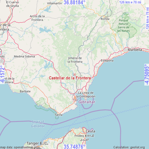
36° 19' 2.496" North, 5° 27' 14.652" West
| Map corner | latitude | longitude |
|---|---|---|
| Upper-left | 36.88184°, | -6.1572° |
| Center: | 36.31736°, | -5.45407° |
| Lower-right: | 35.74876°, | -4.75095° |
| Map W x H: | 126×126 km | = 78.3×78.3mi |
| max Lat: | 43.74134° ⇑98.2% North |
| Castellar de la Frontera: | 36.31736° |
| min Lat: | ⇓1.8% South 27.64134° |
| min Long | Castellar de la | max Long |
| -18.00367° | -5.45407° | 4.2899° |
| W 21.8%⇐ | ⇒78.2% E |
Elevation
Elevation of Castellar de la Frontera is 220 m = 722 ft, and this is 378 m = 1240 ft below average elevation for this country.
| Max E: |
1682 m = 5518 ft | 80% |
| Avg. | 598 m = 1962 ft | |
| Castellar de la Frontera | 220 m = 722 ft | |
Min E: |
0 m = 0 ft | 20% |
See also: Spain elevation on elevation.city.
Geographical zone
Castellar de la Frontera is located in North temperate zone (between Tropic of Cancer and the Arctic Circle). Distance of this Northern Tropic circle is 1432.2 km =889.9 mi to South.| Distance of | km | miles | from Castellar de la Frontera |
|---|---|---|---|
| North Pole | 5969 | 3709 | to North |
| Arctic Circle | 3363.1 | 2089.7 | to North |
| Tropic Cancer | 1432.2 | 889.9 | to South |
| Equator | 4038.1 | 2509.2 | to South |


Nearby cities:
15 places around Castellar de la Frontera: (largest is in red/bold)
• Alcalá de los Gazules
29 km =18 mi,  303°
303°
• Algatocín
32.7 km =20.3 mi,  29°
29°
• Algeciras
20.5 km =12.7 mi,  179°
179°
• Benalup-Casas Viejas
32.3 km =20.1 mi,  275°
275°
• Benarrabá
30.5 km =19 mi, 31°
• Casares
20.8 km =12.9 mi,  46°
46°
• Estepona
30.2 km =18.8 mi,  66°
66°
• Gaucín
25.5 km =15.8 mi, 29°
• Genalguacil
32 km =19.9 mi,  37°
37°
• Jimena de la Frontera
13.1 km =8.1 mi,  0°
0°
• La Línea de la Concepción
19.1 km =11.9 mi,  150°
150°
• Los Barrios
15.1 km =9.4 mi,  193°
193°
• Manilva
19.4 km =12.1 mi, 70°
• San Enrique de Guadiaro
14.7 km =9.1 mi,  95°
95°
• San Roque
13.4 km =8.3 mi, 152°
Sources, notices
• [Note1] Compared only with cities in Spain existing in our database
• [Src1] Map data: © OpenStreetMap contributors (CC-BY-SA)
• [Src2] Other city data from geonames.org with taken over terms of usage.
• [Src3] Geographical zone / Annual Mean Temperature by Robert A. Rohde @ Wikipedia
