Benalup-Casas Viejas geodata
Benalup-Casas Viejas (Andalusia) is a seat of a third-order administrative division; located in Spain in Europe/Madrid (GMT+2) time zone. With population of 6,754 people, there are 1061 cities with bigger population in this country. Compared to other cities in Spain, 98.2% of cities are located further ↑North; 83.4% of cities are located further →East and 86.5% of cities have higher elevation than Benalup-Casas Viejas. Note1
Administrative division(s):
- Level 1: Andalusia
- Level 2: Provincia de Cádiz
- Level 3: Benalup-Casas Viejas


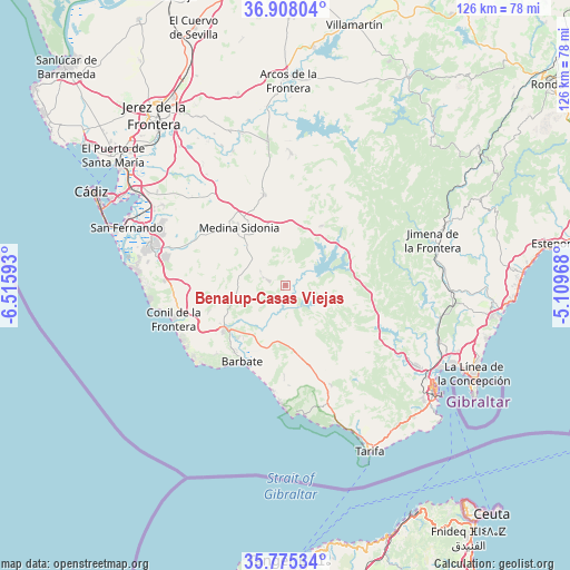
Benalup-Casas Viejas GPS coordinates[2]
36° 20' 37.5" North, 5° 48' 46.08" West
| Map corner | latitude | longitude |
|---|---|---|
| Upper-left | 36.90804°, | -6.51593° |
| Center: | 36.34375°, | -5.8128° |
| Lower-right: | 35.77534°, | -5.10968° |
| Map W x H: | 125.9×125.9 km | = 78.2×78.2mi |
| max Lat: | 43.74134° ⇑98.2% North |
| Benalup-Casas Viejas: | 36.34375° |
| min Lat: | ⇓1.8% South 27.64134° |
| min Long | Benalup-Casas V | max Long |
| -18.00367° | -5.8128° | 4.2899° |
| W 16.6%⇐ | ⇒83.4% E |
Elevation
Elevation of Benalup-Casas Viejas is 116 m = 381 ft, and this is 482 m = 1581 ft below average elevation for this country.
| Max E: |
1682 m = 5518 ft | 86.5% |
| Avg. | 598 m = 1962 ft | |
| Benalup-Casas Viejas | 116 m = 381 ft | |
Min E: |
0 m = 0 ft | 13.5% |
See also: Spain elevation on elevation.city.
Geographical zone
Benalup-Casas Viejas is located in North temperate zone (between Tropic of Cancer and the Arctic Circle). Distance of this Northern Tropic circle is 1435.1 km =891.7 mi to South.| Distance of | km | miles | from Benalup-Casas Viejas |
|---|---|---|---|
| North Pole | 5966 | 3707.1 | to North |
| Arctic Circle | 3360.1 | 2087.9 | to North |
| Tropic Cancer | 1435.1 | 891.7 | to South |
| Equator | 4041 | 2511 | to South |


Nearby cities:
15 places around Benalup-Casas Viejas: (largest is in red/bold)
• Alcalá de los Gazules
15.4 km =9.6 mi,  31°
31°
• Algar
37.6 km =23.4 mi,  21°
21°
• Barbate
19.5 km =12.1 mi,  210°
210°
• Castellar de la Frontera
32.3 km =20.1 mi,  95°
95°
• Chiclana de la Frontera
30.8 km =19.1 mi,  285°
285°
• Conil de la Frontera
25.8 km =16 mi,  253°
253°
• Jimena de la Frontera
33.7 km =20.9 mi,  72°
72°
• Los Barrios
33.7 km =20.9 mi,  121°
121°
• Medina Sidonia
16.2 km =10.1 mi,  320°
320°
• Paterna de Rivera
20.4 km =12.7 mi,  346°
346°
• Puerto Real
39.5 km =24.5 mi,  301°
301°
• San Fernando
37.5 km =23.3 mi, 293°
• San José del Valle
29.1 km =18.1 mi,  2°
2°
• Vejer de la Frontera
17.2 km =10.7 mi,  233°
233°
• Zahara de los Atunes
23.2 km =14.4 mi,  187°
187°
Sources, notices
• [Note1] Compared only with cities in Spain existing in our database
• [Src1] Map data: © OpenStreetMap contributors (CC-BY-SA)
• [Src2] Other city data from geonames.org with taken over terms of usage.
• [Src3] Geographical zone / Annual Mean Temperature by Robert A. Rohde @ Wikipedia
