Granja de Torrehermosa geodata
Granja de Torrehermosa (Extremadura) is a seat of a third-order administrative division; located in Spain in Europe/Madrid (GMT+2) time zone. With population of 2,475 people, there are 1909 cities with bigger population in this country. Compared to other cities in Spain, 86.7% of cities are located further ↑North; 80% of cities are located further →East and 57% of cities have higher elevation than Granja de Torrehermosa. Note1
Administrative division(s):
- Level 1: Extremadura
- Level 2: Provincia de Badajoz
- Level 3: Granja de Torrehermosa
Current local time in Granja de Torrehermosa:
10:40 PM, ThursdayDifference from your time zone: hours


Granja de Torrehermosa GPS coordinates[2]
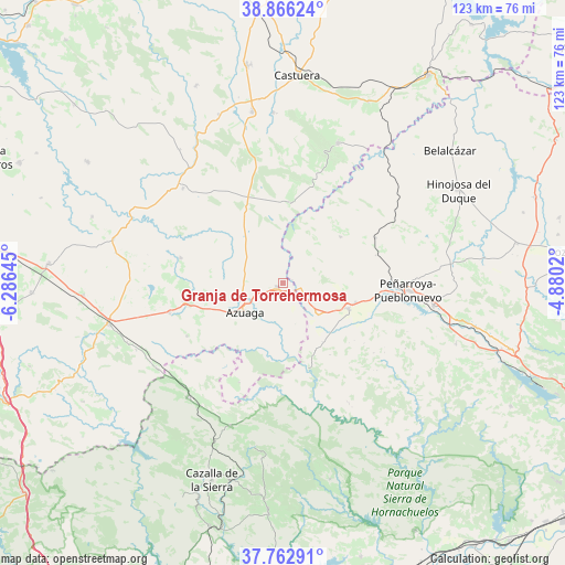
38° 19' 0.012" North, 5° 34' 59.988" West
| Map corner | latitude | longitude |
|---|---|---|
| Upper-left | 38.86624°, | -6.28645° |
| Center: | 38.31667°, | -5.58333° |
| Lower-right: | 37.76291°, | -4.8802° |
| Map W x H: | 122.7×122.7 km | = 76.2×76.2mi |
| max Lat: | 43.74134° ⇑86.7% North |
| Granja de Torrehermosa: | 38.31667° |
| min Lat: | ⇓13.3% South 27.64134° |
| min Long | Granja de Torre | max Long |
| -18.00367° | -5.58333° | 4.2899° |
| W 20%⇐ | ⇒80% E |
Elevation
Elevation of Granja de Torrehermosa is 565 m = 1854 ft, and this is 33 m = 108 ft below average elevation for this country.
| Max E: |
1682 m = 5518 ft | 57% |
| Avg. | 598 m = 1962 ft | |
| Granja de Torrehermosa | 565 m = 1854 ft | |
Min E: |
0 m = 0 ft | 43% |
See also: Spain elevation on elevation.city.
Geographical zone
Granja de Torrehermosa is located in North temperate zone (between Tropic of Cancer and the Arctic Circle). Distance of this Northern Tropic circle is 1654.5 km =1028.1 mi to South.| Distance of | km | miles | from Granja de Torrehermosa |
|---|---|---|---|
| North Pole | 5746.6 | 3570.8 | to North |
| Arctic Circle | 3140.8 | 1951.6 | to North |
| Tropic Cancer | 1654.5 | 1028.1 | to South |
| Equator | 4260.4 | 2647.3 | to South |


Nearby cities:
15 places around Granja de Torrehermosa: (largest is in red/bold)
• Ahillones
23.9 km =14.9 mi,  256°
256°
• Alanís
33.6 km =20.9 mi,  200°
200°
• Azuaga
10.3 km =6.4 mi,  237°
237°
• Berlanga
20.7 km =12.9 mi, 259°
• Blázquez
16 km =9.9 mi,  54°
54°
• Bélmez
33.9 km =21.1 mi,  99°
99°
• Campillo de Llerena
29.9 km =18.6 mi,  313°
313°
• Fuente Obejuna
15.6 km =9.7 mi,  110°
110°
• Fuente del Arco
33.3 km =20.7 mi, 236°
• Guadalcanal
31.6 km =19.6 mi,  220°
220°
• Maguilla
22.5 km =14 mi,  284°
284°
• Malcocinado
23.9 km =14.9 mi, 201°
• Monterrubio de la Serena
32.5 km =20.2 mi,  21°
21°
• Peñarroya-Pueblonuevo
27.7 km =17.2 mi,  93°
93°
• Valverde de Llerena
23.2 km =14.4 mi, 241°
Sources, notices
• [Note1] Compared only with cities in Spain existing in our database
• [Src1] Map data: © OpenStreetMap contributors (CC-BY-SA)
• [Src2] Other city data from geonames.org with taken over terms of usage.
• [Src3] Geographical zone / Annual Mean Temperature by Robert A. Rohde @ Wikipedia
