Ador geodata
Ador (Valencia) is a seat of a third-order administrative division; located in Spain in Europe/Madrid (GMT+2) time zone. With population of 1,346 people, there are 2600 cities with bigger population in this country. Compared to other cities in Spain, 81.9% of cities are located further ↑North; 85.3% of cities are located further ←West and 88.7% of cities have higher elevation than Ador. Note1


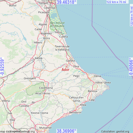
Ador GPS coordinates[2]
38° 55' 5.628" North, 0° 13' 20.892" West
| Map corner | latitude | longitude |
|---|---|---|
| Upper-left | 39.46318°, | -0.92559° |
| Center: | 38.91823°, | -0.22247° |
| Lower-right: | 38.36906°, | 0.48066° |
| Map W x H: | 121.7×121.7 km | = 75.6×75.6mi |
| max Lat: | 43.74134° ⇑81.9% North |
| Ador: | 38.91823° |
| min Lat: | ⇓18.1% South 27.64134° |
| min Long | Ador | max Long |
| -18.00367° | -0.22247° | 4.2899° |
| W 85.3%⇐ | ⇒14.7% E |
Elevation
Elevation of Ador is 85 m = 279 ft, and this is 513 m = 1683 ft below average elevation for this country.
| Max E: |
1682 m = 5518 ft | 88.7% |
| Avg. | 598 m = 1962 ft | |
| Ador | 85 m = 279 ft | |
Min E: |
0 m = 0 ft | 11.3% |
See also: Spain elevation on elevation.city.
Geographical zone
Ador is located in North temperate zone (between Tropic of Cancer and the Arctic Circle). Distance of this Northern Tropic circle is 1721.4 km =1069.6 mi to South.| Distance of | km | miles | from Ador |
|---|---|---|---|
| North Pole | 5679.8 | 3529.3 | to North |
| Arctic Circle | 3073.9 | 1910 | to North |
| Tropic Cancer | 1721.4 | 1069.6 | to South |
| Equator | 4327.3 | 2688.9 | to South |


Nearby cities:
15 places around Ador: (largest is in red/bold)
• Alfauir
2.9 km =1.8 mi,  305°
305°
• Almiserà
5.3 km =3.3 mi,  268°
268°
• Almoines
4.5 km =2.8 mi,  51°
51°
• Bellreguard
6 km =3.7 mi, 53°
• Beniarjó
3.5 km =2.2 mi,  63°
63°
• Beniflá
4 km =2.5 mi,  73°
73°
• Castellonet de la Conquesta
3.8 km =2.4 mi, 267°
• Gandia
6.4 km =4 mi,  32°
32°
• Llocnou de Sant Jeroni
5.3 km =3.3 mi, 268°
• Palma de Gandía
1 km =0.6 mi,  11°
11°
• Potríes
2.3 km =1.4 mi,  95°
95°
• Rafelcofer
5 km =3.1 mi, 71°
• Real de Gandía
4.2 km =2.6 mi,  38°
38°
• Rótova
3.4 km =2.1 mi,  296°
296°
• Villalonga
3.8 km =2.4 mi,  160°
160°
Sources, notices
• [Note1] Compared only with cities in Spain existing in our database
• [Src1] Map data: © OpenStreetMap contributors (CC-BY-SA)
• [Src2] Other city data from geonames.org with taken over terms of usage.
• [Src3] Geographical zone / Annual Mean Temperature by Robert A. Rohde @ Wikipedia
