Villodrigo geodata
Villodrigo (Castille and León) is a seat of a third-order administrative division; located in Spain in Europe/Madrid (GMT+2) time zone. With population of 146 people, there are 5457 cities with bigger population in this country. Compared to other cities in Spain, 77.7% of cities are located further ↓South; 61.1% of cities are located further →East and 62.9% of cities have lower elevation than Villodrigo. Note1
Administrative division(s):
- Level 1: Castille and León
- Level 2: Provincia de Palencia
- Level 3: Villodrigo


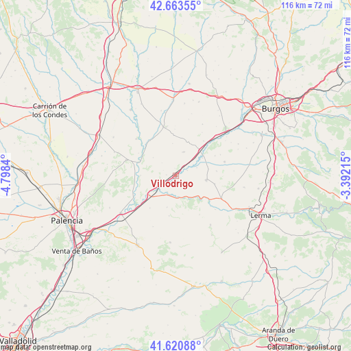
Villodrigo GPS coordinates[2]
42° 8' 39.696" North, 4° 5' 42.972" West
| Map corner | latitude | longitude |
|---|---|---|
| Upper-left | 42.66355°, | -4.7984° |
| Center: | 42.14436°, | -4.09527° |
| Lower-right: | 41.62088°, | -3.39215° |
| Map W x H: | 115.9×115.9 km | = 72×72mi |
| max Lat: | 43.74134° ⇑22.3% North |
| Villodrigo: | 42.14436° |
| min Lat: | ⇓77.7% South 27.64134° |
| min Long | Villodrigo | max Long |
| -18.00367° | -4.09527° | 4.2899° |
| W 38.9%⇐ | ⇒61.1% E |
Elevation
Elevation of Villodrigo is 764 m = 2507 ft, and this is 166 m = 545 ft above average elevation for this country.
| Max E: |
1682 m = 5518 ft | 37.1% |
| Villodrigo | 764 m 2507 ft | |
| Avg. | 598 m = 1962 ft | |
Min E: |
0 m = 0 ft | 62.9% |
See also: Spain elevation on elevation.city.
Geographical zone
Villodrigo is located in North temperate zone (between Tropic of Cancer and the Arctic Circle). Distance of this Northern Tropic circle is 2080.1 km =1292.5 mi to South.| Distance of | km | miles | from Villodrigo |
|---|---|---|---|
| North Pole | 5321 | 3306.3 | to North |
| Arctic Circle | 2715.2 | 1687.1 | to North |
| Tropic Cancer | 2080.1 | 1292.5 | to South |
| Equator | 4686 | 2911.7 | to South |


Nearby cities:
15 places around Villodrigo: (largest is in red/bold)
• Barrio de Muñó
8.1 km =5 mi,  64°
64°
• Belbimbre
7.3 km =4.5 mi,  68°
68°
• Palazuelos de Muñó
10.5 km =6.5 mi, 56°
• Palenzuela
6.2 km =3.9 mi,  207°
207°
• Pampliega
11.3 km =7 mi,  52°
52°
• Peral de Arlanza
7.7 km =4.8 mi,  168°
168°
• Quintana del Puente
11.3 km =7 mi,  234°
234°
• Santa María del Campo
10.2 km =6.3 mi,  97°
97°
• Valbuena de Pisuerga
11.9 km =7.4 mi,  270°
270°
• Valles de Palenzuela
3.1 km =1.9 mi,  151°
151°
• Villahán
10.9 km =6.8 mi,  195°
195°
• Villamedianilla
4.6 km =2.9 mi,  293°
293°
• Villaquirán de los Infantes
11.7 km =7.3 mi,  37°
37°
• Villaverde-Mogina
4.1 km =2.5 mi, 64°
• Villazopeque
8.8 km =5.5 mi, 47°
Sources, notices
• [Note1] Compared only with cities in Spain existing in our database
• [Src1] Map data: © OpenStreetMap contributors (CC-BY-SA)
• [Src2] Other city data from geonames.org with taken over terms of usage.
• [Src3] Geographical zone / Annual Mean Temperature by Robert A. Rohde @ Wikipedia
