Palenzuela geodata
Palenzuela (Castille and León) is a seat of a third-order administrative division; located in Spain in Europe/Madrid (GMT+2) time zone. With population of 266 people, there are 4659 cities with bigger population in this country. Compared to other cities in Spain, 76.4% of cities are located further ↓South; 61.7% of cities are located further →East and 66.9% of cities have lower elevation than Palenzuela. Note1
Administrative division(s):
- Level 1: Castille and León
- Level 2: Provincia de Palencia
- Level 3: Palenzuela


Palenzuela GPS coordinates[2]
42° 5' 42.648" North, 4° 7' 49.404" West
| Map corner | latitude | longitude |
|---|---|---|
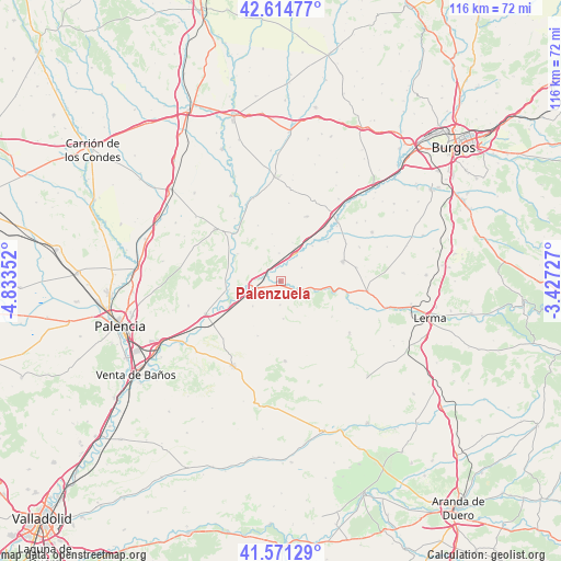
| Upper-left | 42.61477°, | -4.83352° |
| Center: | 42.09518°, | -4.13039° |
| Lower-right: | 41.57129°, | -3.42727° |
| Map W x H: | 116×116 km | = 72.1×72.1mi |
| max Lat: | 43.74134° ⇑23.6% North |
| Palenzuela: | 42.09518° |
| min Lat: | ⇓76.4% South 27.64134° |
| min Long | Palenzuela | max Long |
| -18.00367° | -4.13039° | 4.2899° |
| W 38.3%⇐ | ⇒61.7% E |
Elevation
Elevation of Palenzuela is 791 m = 2595 ft, and this is 193 m = 633 ft above average elevation for this country.
| Max E: |
1682 m = 5518 ft | 33.1% |
| Palenzuela | 791 m 2595 ft | |
| Avg. | 598 m = 1962 ft | |
Min E: |
0 m = 0 ft | 66.9% |
See also: Spain elevation on elevation.city.
Geographical zone
Palenzuela is located in North temperate zone (between Tropic of Cancer and the Arctic Circle). Distance of this Northern Tropic circle is 2074.6 km =1289.1 mi to South.| Distance of | km | miles | from Palenzuela |
|---|---|---|---|
| North Pole | 5326.5 | 3309.7 | to North |
| Arctic Circle | 2720.6 | 1690.5 | to North |
| Tropic Cancer | 2074.6 | 1289.1 | to South |
| Equator | 4680.5 | 2908.3 | to South |


Nearby cities:
15 places around Palenzuela: (largest is in red/bold)
• Barrio de Muñó
13.6 km =8.5 mi,  48°
48°
• Belbimbre
12.7 km =7.9 mi, 49°
• Cobos de Cerrato
12.9 km =8 mi,  125°
125°
• Cordovilla la Real
10.8 km =6.7 mi,  260°
260°
• Herrera de Valdecañas
7.8 km =4.8 mi,  227°
227°
• Peral de Arlanza
4.9 km =3 mi,  115°
115°
• Quintana del Puente
6.4 km =4 mi, 259°
• Tabanera de Cerrato
7.9 km =4.9 mi,  175°
175°
• Valbuena de Pisuerga
10.7 km =6.6 mi,  301°
301°
• Valles de Palenzuela
5.2 km =3.2 mi,  57°
57°
• Villahán
5 km =3.1 mi, 180°
• Villalaco
12.6 km =7.8 mi, 302°
• Villamedianilla
7.4 km =4.6 mi,  350°
350°
• Villaverde-Mogina
9.8 km =6.1 mi,  42°
42°
• Villodrigo
6.2 km =3.9 mi,  27°
27°
Sources, notices
• [Note1] Compared only with cities in Spain existing in our database
• [Src1] Map data: © OpenStreetMap contributors (CC-BY-SA)
• [Src2] Other city data from geonames.org with taken over terms of usage.
• [Src3] Geographical zone / Annual Mean Temperature by Robert A. Rohde @ Wikipedia
