Villaquirán de los Infantes geodata
Villaquirán de los Infantes (Castille and León) is a seat of a third-order administrative division; located in Spain in Europe/Madrid (GMT+2) time zone. With population of 175 people, there are 5220 cities with bigger population in this country. Compared to other cities in Spain, 80% of cities are located further ↓South; 59.8% of cities are located further →East and 69.8% of cities have lower elevation than Villaquirán de los Infantes. Note1
Administrative division(s):
- Level 1: Castille and León
- Level 2: Provincia de Burgos
- Level 3: Villaquirán de los Infantes
Current local time in Villaquirán de los Infantes:
01:21 AM, FridayDifference from your time zone: hours


Villaquirán de los Infantes GPS coordinates[2]
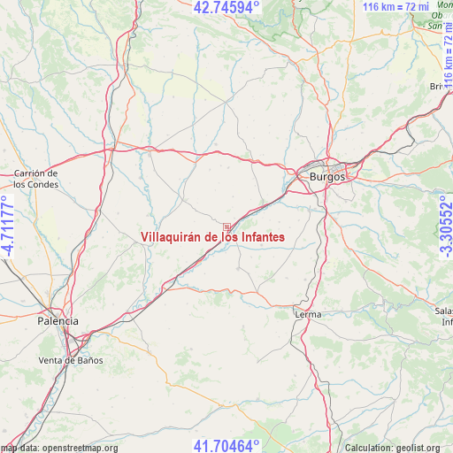
42° 13' 38.784" North, 4° 0' 31.104" West
| Map corner | latitude | longitude |
|---|---|---|
| Upper-left | 42.74594°, | -4.71177° |
| Center: | 42.22744°, | -4.00864° |
| Lower-right: | 41.70464°, | -3.30552° |
| Map W x H: | 115.8×115.8 km | = 72×72mi |
| max Lat: | 43.74134° ⇑20% North |
| Villaquirán de los Infantes: | 42.22744° |
| min Lat: | ⇓80% South 27.64134° |
| min Long | Villaquirán de | max Long |
| -18.00367° | -4.00864° | 4.2899° |
| W 40.2%⇐ | ⇒59.8% E |
Elevation
Elevation of Villaquirán de los Infantes is 813 m = 2667 ft, and this is 215 m = 705 ft above average elevation for this country.
| Max E: |
1682 m = 5518 ft | 30.2% |
| Villaquirán de los Infantes | 813 m 2667 ft | |
| Avg. | 598 m = 1962 ft | |
Min E: |
0 m = 0 ft | 69.8% |
See also: Spain elevation on elevation.city.
Geographical zone
Villaquirán de los Infantes is located in North temperate zone (between Tropic of Cancer and the Arctic Circle). Distance of this Northern Tropic circle is 2089.3 km =1298.2 mi to South.| Distance of | km | miles | from Villaquirán de los Infantes |
|---|---|---|---|
| North Pole | 5311.8 | 3300.6 | to North |
| Arctic Circle | 2705.9 | 1681.4 | to North |
| Tropic Cancer | 2089.3 | 1298.2 | to South |
| Equator | 4695.3 | 2917.5 | to South |


Nearby cities:
15 places around Villaquirán de los Infantes: (largest is in red/bold)
• Barrio de Muñó
5.7 km =3.5 mi,  178°
178°
• Belbimbre
6.5 km =4 mi, 183°
• Celada del Camino
7.4 km =4.6 mi,  56°
56°
• Ciadoncha
9.9 km =6.2 mi,  140°
140°
• Iglesias
8 km =5 mi,  11°
11°
• Mazuela
7.7 km =4.8 mi,  106°
106°
• Olmillos de Muñó
6.3 km =3.9 mi,  115°
115°
• Palazuelos de Muñó
3.7 km =2.3 mi,  155°
155°
• Pampliega
3 km =1.9 mi, 143°
• Presencio
9.9 km =6.2 mi, 117°
• Tamarón
5.3 km =3.3 mi,  15°
15°
• Villaldemiro
2.9 km =1.8 mi,  41°
41°
• Villaquirán de la Puebla
9.7 km =6 mi,  309°
309°
• Villaverde-Mogina
8.2 km =5.1 mi,  204°
204°
• Villazopeque
3.3 km =2.1 mi,  191°
191°
Sources, notices
• [Note1] Compared only with cities in Spain existing in our database
• [Src1] Map data: © OpenStreetMap contributors (CC-BY-SA)
• [Src2] Other city data from geonames.org with taken over terms of usage.
• [Src3] Geographical zone / Annual Mean Temperature by Robert A. Rohde @ Wikipedia
