Villahán geodata
Villahán (Castille and León) is a seat of a third-order administrative division; located in Spain in Europe/Madrid (GMT+2) time zone. With population of 117 people, there are 5732 cities with bigger population in this country. Compared to other cities in Spain, 75.1% of cities are located further ↓South; 61.7% of cities are located further →East and 69.1% of cities have lower elevation than Villahán. Note1
Administrative division(s):
- Level 1: Castille and León
- Level 2: Provincia de Palencia
- Level 3: Villahán


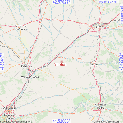
Villahán GPS coordinates[2]
42° 3' 1.116" North, 4° 7' 51.744" West
| Map corner | latitude | longitude |
|---|---|---|
| Upper-left | 42.57027°, | -4.83417° |
| Center: | 42.05031°, | -4.13104° |
| Lower-right: | 41.52606°, | -3.42792° |
| Map W x H: | 116.1×116.1 km | = 72.1×72.1mi |
| max Lat: | 43.74134° ⇑24.9% North |
| Villahán: | 42.05031° |
| min Lat: | ⇓75.1% South 27.64134° |
| min Long | Villahán | max Long |
| -18.00367° | -4.13104° | 4.2899° |
| W 38.3%⇐ | ⇒61.7% E |
Elevation
Elevation of Villahán is 807 m = 2648 ft, and this is 209 m = 686 ft above average elevation for this country.
| Max E: |
1682 m = 5518 ft | 30.9% |
| Villahán | 807 m 2648 ft | |
| Avg. | 598 m = 1962 ft | |
Min E: |
0 m = 0 ft | 69.1% |
See also: Spain elevation on elevation.city.
Geographical zone
Villahán is located in North temperate zone (between Tropic of Cancer and the Arctic Circle). Distance of this Northern Tropic circle is 2069.6 km =1286 mi to South.| Distance of | km | miles | from Villahán |
|---|---|---|---|
| North Pole | 5331.5 | 3312.8 | to North |
| Arctic Circle | 2725.6 | 1693.6 | to North |
| Tropic Cancer | 2069.6 | 1286 | to South |
| Equator | 4675.6 | 2905.3 | to South |


Nearby cities:
15 places around Villahán: (largest is in red/bold)
• Antigüedad
11.5 km =7.1 mi,  175°
175°
• Cobos de Cerrato
10.9 km =6.8 mi,  103°
103°
• Cordovilla la Real
11.1 km =6.9 mi,  287°
287°
• Herrera de Valdecañas
5.7 km =3.5 mi,  267°
267°
• Hornillos de Cerrato
13.6 km =8.5 mi,  239°
239°
• Palenzuela
5 km =3.1 mi,  0°
0°
• Peral de Arlanza
5.3 km =3.3 mi,  57°
57°
• Quintana del Puente
7.3 km =4.5 mi,  301°
301°
• Royuela de Río Franco
15.5 km =9.6 mi,  110°
110°
• Tabanera de Cerrato
2.9 km =1.8 mi,  167°
167°
• Valbuena de Pisuerga
13.9 km =8.6 mi,  319°
319°
• Valles de Palenzuela
8.9 km =5.5 mi,  29°
29°
• Villamedianilla
12.3 km =7.6 mi,  354°
354°
• Villaverde-Mogina
13.9 km =8.6 mi, 28°
• Villodrigo
10.9 km =6.8 mi,  15°
15°
Sources, notices
• [Note1] Compared only with cities in Spain existing in our database
• [Src1] Map data: © OpenStreetMap contributors (CC-BY-SA)
• [Src2] Other city data from geonames.org with taken over terms of usage.
• [Src3] Geographical zone / Annual Mean Temperature by Robert A. Rohde @ Wikipedia
