Villárdiga geodata
Villárdiga (Castille and León) is a seat of a third-order administrative division; located in Spain in Europe/Madrid (GMT+2) time zone. With population of 100 people, there are 5934 cities with bigger population in this country. Compared to other cities in Spain, 69% of cities are located further ↓South; 78.3% of cities are located further →East and 52.5% of cities have lower elevation than Villárdiga. Note1
Administrative division(s):
- Level 1: Castille and León
- Level 2: Provincia de Zamora
- Level 3: Villárdiga


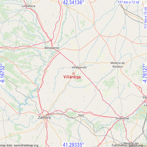
Villárdiga GPS coordinates[2]
41° 49' 10.2" North, 5° 27' 51.804" West
| Map corner | latitude | longitude |
|---|---|---|
| Upper-left | 42.34136°, | -6.16752° |
| Center: | 41.8195°, | -5.46439° |
| Lower-right: | 41.29335°, | -4.76127° |
| Map W x H: | 116.5×116.5 km | = 72.4×72.4mi |
| max Lat: | 43.74134° ⇑31% North |
| Villárdiga: | 41.8195° |
| min Lat: | ⇓69% South 27.64134° |
| min Long | Villárdiga | max Long |
| -18.00367° | -5.46439° | 4.2899° |
| W 21.7%⇐ | ⇒78.3% E |
Elevation
Elevation of Villárdiga is 685 m = 2247 ft, and this is 87 m = 285 ft above average elevation for this country.
| Max E: |
1682 m = 5518 ft | 47.5% |
| Villárdiga | 685 m 2247 ft | |
| Avg. | 598 m = 1962 ft | |
Min E: |
0 m = 0 ft | 52.5% |
See also: Spain elevation on elevation.city.
Geographical zone
Villárdiga is located in North temperate zone (between Tropic of Cancer and the Arctic Circle). Distance of this Northern Tropic circle is 2044 km =1270.1 mi to South.| Distance of | km | miles | from Villárdiga |
|---|---|---|---|
| North Pole | 5357.2 | 3328.8 | to North |
| Arctic Circle | 2751.3 | 1709.6 | to North |
| Tropic Cancer | 2044 | 1270.1 | to South |
| Equator | 4649.9 | 2889.3 | to South |


Nearby cities:
15 places around Villárdiga: (largest is in red/bold)
• Belver de los Montes
10.8 km =6.7 mi,  174°
174°
• Castronuevo
12.8 km =8 mi,  210°
210°
• Cañizo
6.4 km =4 mi, 209°
• Cerecinos de Campos
9.1 km =5.7 mi,  348°
348°
• Prado
11.8 km =7.3 mi,  17°
17°
• Quintanilla del Monte
11 km =6.8 mi,  60°
60°
• Quintanilla del Olmo
10.7 km =6.6 mi,  26°
26°
• Revellinos
11.7 km =7.3 mi,  312°
312°
• San Agustín del Pozo
13 km =8.1 mi,  304°
304°
• San Martín de Valderaduey
0.9 km =0.6 mi,  228°
228°
• Tapioles
5 km =3.1 mi,  327°
327°
• Vidayanes
13.6 km =8.5 mi,  317°
317°
• Villafáfila
12.9 km =8 mi,  283°
283°
• Villalpando
6.7 km =4.2 mi,  40°
40°
• Villamayor de Campos
12.4 km =7.7 mi, 44°
Sources, notices
• [Note1] Compared only with cities in Spain existing in our database
• [Src1] Map data: © OpenStreetMap contributors (CC-BY-SA)
• [Src2] Other city data from geonames.org with taken over terms of usage.
• [Src3] Geographical zone / Annual Mean Temperature by Robert A. Rohde @ Wikipedia
