Revellinos geodata
Revellinos (Castille and León) is a seat of a third-order administrative division; located in Spain in Europe/Madrid (GMT+2) time zone. With population of 301 people, there are 4497 cities with bigger population in this country. Compared to other cities in Spain, 70.7% of cities are located further ↓South; 79.7% of cities are located further →East and 53.7% of cities have lower elevation than Revellinos. Note1
Administrative division(s):
- Level 1: Castille and León
- Level 2: Provincia de Zamora
- Level 3: Revellinos


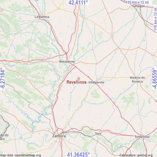
Revellinos GPS coordinates[2]
41° 53' 23.352" North, 5° 34' 7.356" West
| Map corner | latitude | longitude |
|---|---|---|
| Upper-left | 42.4111°, | -6.27184° |
| Center: | 41.88982°, | -5.56871° |
| Lower-right: | 41.36425°, | -4.86559° |
| Map W x H: | 116.4×116.4 km | = 72.3×72.3mi |
| max Lat: | 43.74134° ⇑29.3% North |
| Revellinos: | 41.88982° |
| min Lat: | ⇓70.7% South 27.64134° |
| min Long | Revellinos | max Long |
| -18.00367° | -5.56871° | 4.2899° |
| W 20.3%⇐ | ⇒79.7% E |
Elevation
Elevation of Revellinos is 697 m = 2287 ft, and this is 99 m = 325 ft above average elevation for this country.
| Max E: |
1682 m = 5518 ft | 46.3% |
| Revellinos | 697 m 2287 ft | |
| Avg. | 598 m = 1962 ft | |
Min E: |
0 m = 0 ft | 53.7% |
See also: Spain elevation on elevation.city.
Geographical zone
Revellinos is located in North temperate zone (between Tropic of Cancer and the Arctic Circle). Distance of this Northern Tropic circle is 2051.8 km =1274.9 mi to South.| Distance of | km | miles | from Revellinos |
|---|---|---|---|
| North Pole | 5349.4 | 3324 | to North |
| Arctic Circle | 2743.5 | 1704.7 | to North |
| Tropic Cancer | 2051.8 | 1274.9 | to South |
| Equator | 4657.7 | 2894.2 | to South |


Nearby cities:
15 places around Revellinos: (largest is in red/bold)
• Arcos de la Polvorosa
12.2 km =7.6 mi,  299°
299°
• Barcial del Barco
9.2 km =5.7 mi, 302°
• Castrogonzalo
11.6 km =7.2 mi,  345°
345°
• Cerecinos de Campos
6.9 km =4.3 mi,  80°
80°
• San Agustín del Pozo
2.1 km =1.3 mi,  258°
258°
• San Esteban del Molar
5.5 km =3.4 mi,  15°
15°
• San Martín de Valderaduey
11.6 km =7.2 mi,  136°
136°
• Santovenia
11.8 km =7.3 mi, 263°
• Tapioles
7 km =4.3 mi,  120°
120°
• Vidayanes
2.3 km =1.4 mi, 348°
• Villafáfila
6.1 km =3.8 mi,  218°
218°
• Villalobos
9.9 km =6.2 mi,  51°
51°
• Villarrín de Campos
12 km =7.5 mi,  208°
208°
• Villaveza del Agua
9.7 km =6 mi,  289°
289°
• Villárdiga
11.7 km =7.3 mi,  132°
132°
Sources, notices
• [Note1] Compared only with cities in Spain existing in our database
• [Src1] Map data: © OpenStreetMap contributors (CC-BY-SA)
• [Src2] Other city data from geonames.org with taken over terms of usage.
• [Src3] Geographical zone / Annual Mean Temperature by Robert A. Rohde @ Wikipedia
