Almendra geodata
Almendra (Castille and León) is a seat of a third-order administrative division; located in Spain in Europe/Madrid (GMT+2) time zone. With population of 226 people, there are 4882 cities with bigger population in this country. Compared to other cities in Spain, 53.9% of cities are located further ↓South; 89.8% of cities are located further →East and 63.1% of cities have lower elevation than Almendra. Note1
Administrative division(s):
- Level 1: Castille and León
- Level 2: Provincia de Salamanca
- Level 3: Almendra


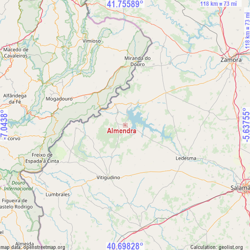
Almendra GPS coordinates[2]
41° 13' 45.192" North, 6° 20' 26.448" West
| Map corner | latitude | longitude |
|---|---|---|
| Upper-left | 41.75589°, | -7.0438° |
| Center: | 41.22922°, | -6.34068° |
| Lower-right: | 40.69828°, | -5.63755° |
| Map W x H: | 117.6×117.6 km | = 73.1×73.1mi |
| max Lat: | 43.74134° ⇑46.1% North |
| Almendra: | 41.22922° |
| min Lat: | ⇓53.9% South 27.64134° |
| min Long | Almendra | max Long |
| -18.00367° | -6.34068° | 4.2899° |
| W 10.2%⇐ | ⇒89.8% E |
Elevation
Elevation of Almendra is 765 m = 2510 ft, and this is 167 m = 548 ft above average elevation for this country.
| Max E: |
1682 m = 5518 ft | 36.9% |
| Almendra | 765 m 2510 ft | |
| Avg. | 598 m = 1962 ft | |
Min E: |
0 m = 0 ft | 63.1% |
See also: Spain elevation on elevation.city.
Geographical zone
Almendra is located in North temperate zone (between Tropic of Cancer and the Arctic Circle). Distance of this Northern Tropic circle is 1978.3 km =1229.3 mi to South.| Distance of | km | miles | from Almendra |
|---|---|---|---|
| North Pole | 5422.8 | 3369.6 | to North |
| Arctic Circle | 2816.9 | 1750.3 | to North |
| Tropic Cancer | 1978.3 | 1229.3 | to South |
| Equator | 4584.3 | 2848.6 | to South |


Nearby cities:
15 places around Almendra: (largest is in red/bold)
• Ahigal de Villarino
8.6 km =5.3 mi,  202°
202°
• Brincones
12.9 km =8 mi,  182°
182°
• Carbellino
16 km =9.9 mi,  89°
89°
• Fermoselle
10.8 km =6.7 mi,  334°
334°
• Iruelos
9.8 km =6.1 mi,  173°
173°
• Monleras
10.7 km =6.6 mi,  116°
116°
• Puertas
15.4 km =9.6 mi,  163°
163°
• Salce
11.2 km =7 mi,  66°
66°
• Sanchón de la Ribera
16.8 km =10.4 mi, 201°
• Sardón de los Frailes
6.1 km =3.8 mi,  106°
106°
• Trabanca
3.7 km =2.3 mi,  276°
276°
• Villar de Samaniego
14.7 km =9.1 mi,  211°
211°
• Villar del Buey
16.9 km =10.5 mi,  48°
48°
• Villarino de los Aires
11.7 km =7.3 mi,  293°
293°
• Villaseco de los Reyes
15 km =9.3 mi, 119°
Sources, notices
• [Note1] Compared only with cities in Spain existing in our database
• [Src1] Map data: © OpenStreetMap contributors (CC-BY-SA)
• [Src2] Other city data from geonames.org with taken over terms of usage.
• [Src3] Geographical zone / Annual Mean Temperature by Robert A. Rohde @ Wikipedia
