Ciadoncha geodata
Ciadoncha (Castille and León) is a seat of a third-order administrative division; located in Spain in Europe/Madrid (GMT+2) time zone. With population of 93 people, there are 6020 cities with bigger population in this country. Compared to other cities in Spain, 78.1% of cities are located further ↓South; 58.8% of cities are located further →East and 67% of cities have lower elevation than Ciadoncha. Note1
Administrative division(s):
- Level 1: Castille and León
- Level 2: Provincia de Burgos
- Level 3: Ciadoncha


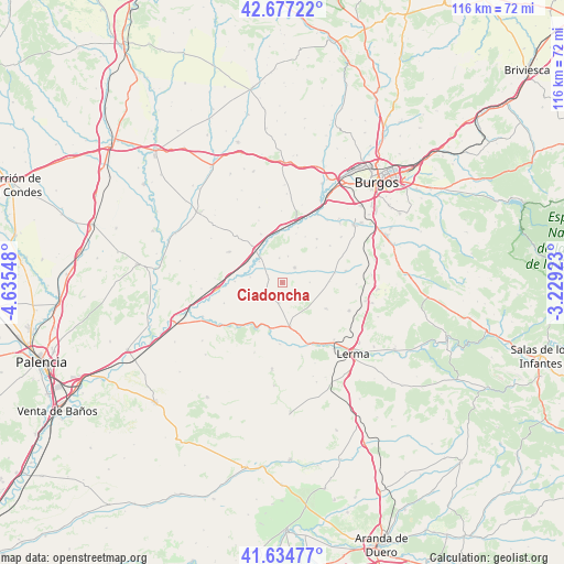
Ciadoncha GPS coordinates[2]
42° 9' 29.304" North, 3° 55' 56.46" West
| Map corner | latitude | longitude |
|---|---|---|
| Upper-left | 42.67722°, | -4.63548° |
| Center: | 42.15814°, | -3.93235° |
| Lower-right: | 41.63477°, | -3.22923° |
| Map W x H: | 115.9×115.9 km | = 72×72mi |
| max Lat: | 43.74134° ⇑21.9% North |
| Ciadoncha: | 42.15814° |
| min Lat: | ⇓78.1% South 27.64134° |
| min Long | Ciadoncha | max Long |
| -18.00367° | -3.93235° | 4.2899° |
| W 41.2%⇐ | ⇒58.8% E |
Elevation
Elevation of Ciadoncha is 792 m = 2598 ft, and this is 194 m = 636 ft above average elevation for this country.
| Max E: |
1682 m = 5518 ft | 33% |
| Ciadoncha | 792 m 2598 ft | |
| Avg. | 598 m = 1962 ft | |
Min E: |
0 m = 0 ft | 67% |
See also: Spain elevation on elevation.city.
Geographical zone
Ciadoncha is located in North temperate zone (between Tropic of Cancer and the Arctic Circle). Distance of this Northern Tropic circle is 2081.6 km =1293.4 mi to South.| Distance of | km | miles | from Ciadoncha |
|---|---|---|---|
| North Pole | 5319.5 | 3305.4 | to North |
| Arctic Circle | 2713.6 | 1686.2 | to North |
| Tropic Cancer | 2081.6 | 1293.4 | to South |
| Equator | 4687.5 | 2912.7 | to South |


Nearby cities:
15 places around Ciadoncha: (largest is in red/bold)
• Barrio de Muñó
6.5 km =4 mi,  287°
287°
• Belbimbre
6.7 km =4.2 mi,  280°
280°
• Mahamud
4.3 km =2.7 mi,  189°
189°
• Mazuela
5.6 km =3.5 mi,  11°
11°
• Olmillos de Muñó
5 km =3.1 mi,  353°
353°
• Palazuelos de Muñó
6.4 km =4 mi,  312°
312°
• Pampliega
6.9 km =4.3 mi,  319°
319°
• Presencio
4.1 km =2.5 mi,  38°
38°
• Santa María del Campo
4.4 km =2.7 mi,  230°
230°
• Villahoz
9.3 km =5.8 mi,  170°
170°
• Villaquirán de los Infantes
9.9 km =6.2 mi, 320°
• Villaverde del Monte
9.7 km =6 mi,  88°
88°
• Villaverde-Mogina
9.7 km =6 mi,  271°
271°
• Villazopeque
8.3 km =5.2 mi,  302°
302°
• Zael
10.5 km =6.5 mi,  123°
123°
Sources, notices
• [Note1] Compared only with cities in Spain existing in our database
• [Src1] Map data: © OpenStreetMap contributors (CC-BY-SA)
• [Src2] Other city data from geonames.org with taken over terms of usage.
• [Src3] Geographical zone / Annual Mean Temperature by Robert A. Rohde @ Wikipedia
