Iglesias geodata
Iglesias (Castille and León) is a seat of a third-order administrative division; located in Spain in Europe/Madrid (GMT+2) time zone. With population of 153 people, there are 5403 cities with bigger population in this country. Compared to other cities in Spain, 81.7% of cities are located further ↓South; 59.5% of cities are located further →East and 74.4% of cities have lower elevation than Iglesias. Note1
Administrative division(s):
- Level 1: Castille and León
- Level 2: Provincia de Burgos
- Level 3: Iglesias


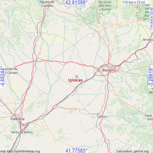
Iglesias GPS coordinates[2]
42° 17' 53.052" North, 3° 59' 21.552" West
| Map corner | latitude | longitude |
|---|---|---|
| Upper-left | 42.81599°, | -4.69244° |
| Center: | 42.29807°, | -3.98932° |
| Lower-right: | 41.77585°, | -3.28619° |
| Map W x H: | 115.7×115.7 km | = 71.9×71.9mi |
| max Lat: | 43.74134° ⇑18.3% North |
| Iglesias: | 42.29807° |
| min Lat: | ⇓81.7% South 27.64134° |
| min Long | Iglesias | max Long |
| -18.00367° | -3.98932° | 4.2899° |
| W 40.5%⇐ | ⇒59.5% E |
Elevation
Elevation of Iglesias is 847 m = 2779 ft, and this is 249 m = 817 ft above average elevation for this country.
| Max E: |
1682 m = 5518 ft | 25.6% |
| Iglesias | 847 m 2779 ft | |
| Avg. | 598 m = 1962 ft | |
Min E: |
0 m = 0 ft | 74.4% |
See also: Spain elevation on elevation.city.
Geographical zone
Iglesias is located in North temperate zone (between Tropic of Cancer and the Arctic Circle). Distance of this Northern Tropic circle is 2097.2 km =1303.1 mi to South.| Distance of | km | miles | from Iglesias |
|---|---|---|---|
| North Pole | 5304 | 3295.8 | to North |
| Arctic Circle | 2698.1 | 1676.5 | to North |
| Tropic Cancer | 2097.2 | 1303.1 | to South |
| Equator | 4703.1 | 2922.4 | to South |


Nearby cities:
15 places around Iglesias: (largest is in red/bold)
• Castellanos de Castro
5 km =3.1 mi,  312°
312°
• Celada del Camino
6 km =3.7 mi,  129°
129°
• Estépar
7.7 km =4.8 mi,  107°
107°
• Hontanas
4.9 km =3 mi,  289°
289°
• Hornillos del Camino
6.9 km =4.3 mi,  49°
49°
• Isar
8.5 km =5.3 mi,  34°
34°
• Olmillos de Muñó
11.3 km =7 mi,  158°
158°
• Palazuelos de Muñó
11.2 km =7 mi,  180°
180°
• Pampliega
10.3 km =6.4 mi, 178°
• Tamarón
2.7 km =1.7 mi, 183°
• Villaldemiro
5.7 km =3.5 mi, 176°
• Villanueva de Argaño
10.2 km =6.3 mi, 26°
• Villaquirán de la Puebla
9.3 km =5.8 mi,  259°
259°
• Villaquirán de los Infantes
8 km =5 mi,  191°
191°
• Villazopeque
11.3 km =7 mi, 191°
Sources, notices
• [Note1] Compared only with cities in Spain existing in our database
• [Src1] Map data: © OpenStreetMap contributors (CC-BY-SA)
• [Src2] Other city data from geonames.org with taken over terms of usage.
• [Src3] Geographical zone / Annual Mean Temperature by Robert A. Rohde @ Wikipedia
