Cordovilla la Real geodata
Cordovilla la Real (Castille and León) is a seat of a third-order administrative division; located in Spain in Europe/Madrid (GMT+2) time zone. With population of 115 people, there are 5757 cities with bigger population in this country. Compared to other cities in Spain, 76% of cities are located further ↓South; 63.4% of cities are located further →East and 60% of cities have lower elevation than Cordovilla la Real. Note1
Administrative division(s):
- Level 1: Castille and León
- Level 2: Provincia de Palencia
- Level 3: Cordovilla la Real


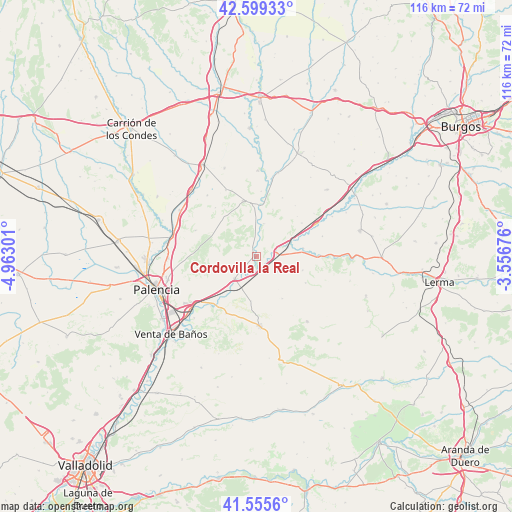
Cordovilla la Real GPS coordinates[2]
42° 4' 46.596" North, 4° 15' 35.568" West
| Map corner | latitude | longitude |
|---|---|---|
| Upper-left | 42.59933°, | -4.96301° |
| Center: | 42.07961°, | -4.25988° |
| Lower-right: | 41.5556°, | -3.55676° |
| Map W x H: | 116.1×116.1 km | = 72.1×72.1mi |
| max Lat: | 43.74134° ⇑24% North |
| Cordovilla la Real: | 42.07961° |
| min Lat: | ⇓76% South 27.64134° |
| min Long | Cordovilla la R | max Long |
| -18.00367° | -4.25988° | 4.2899° |
| W 36.6%⇐ | ⇒63.4% E |
Elevation
Elevation of Cordovilla la Real is 745 m = 2444 ft, and this is 147 m = 482 ft above average elevation for this country.
| Max E: |
1682 m = 5518 ft | 40% |
| Cordovilla la Real | 745 m 2444 ft | |
| Avg. | 598 m = 1962 ft | |
Min E: |
0 m = 0 ft | 60% |
See also: Spain elevation on elevation.city.
Geographical zone
Cordovilla la Real is located in North temperate zone (between Tropic of Cancer and the Arctic Circle). Distance of this Northern Tropic circle is 2072.9 km =1288 mi to South.| Distance of | km | miles | from Cordovilla la Real |
|---|---|---|---|
| North Pole | 5328.2 | 3310.8 | to North |
| Arctic Circle | 2722.4 | 1691.6 | to North |
| Tropic Cancer | 2072.9 | 1288 | to South |
| Equator | 4678.8 | 2907.3 | to South |


Nearby cities:
15 places around Cordovilla la Real: (largest is in red/bold)
• Astudillo
12.9 km =8 mi,  347°
347°
• Herrera de Valdecañas
6 km =3.7 mi,  125°
125°
• Hornillos de Cerrato
10.3 km =6.4 mi,  185°
185°
• Palenzuela
10.8 km =6.7 mi,  80°
80°
• Quintana del Puente
4.4 km =2.7 mi, 82°
• Tabanera de Cerrato
12.8 km =8 mi,  118°
118°
• Torquemada
6.9 km =4.3 mi,  224°
224°
• Valbuena de Pisuerga
7.5 km =4.7 mi,  12°
12°
• Valdeolmillos
12.3 km =7.6 mi,  249°
249°
• Villahán
11.1 km =6.9 mi,  107°
107°
• Villalaco
8.5 km =5.3 mi,  0°
0°
• Villamediana
9 km =5.6 mi, 248°
• Villamedianilla
13 km =8.1 mi,  46°
46°
• Villaviudas
14.7 km =9.1 mi,  207°
207°
• Villodre
14.7 km =9.1 mi, 4°
Sources, notices
• [Note1] Compared only with cities in Spain existing in our database
• [Src1] Map data: © OpenStreetMap contributors (CC-BY-SA)
• [Src2] Other city data from geonames.org with taken over terms of usage.
• [Src3] Geographical zone / Annual Mean Temperature by Robert A. Rohde @ Wikipedia
