Villacastín geodata
Villacastín (Castille and León) is a seat of a third-order administrative division; located in Spain in Europe/Madrid (GMT+2) time zone. With population of 1,619 people, there are 2388 cities with bigger population in this country. Compared to other cities in Spain, 56.6% of cities are located further ↑North; 65.1% of cities are located further →East and 93.4% of cities have lower elevation than Villacastín. Note1
Administrative division(s):
- Level 1: Castille and León
- Level 2: Provincia de Segovia
- Level 3: Villacastín


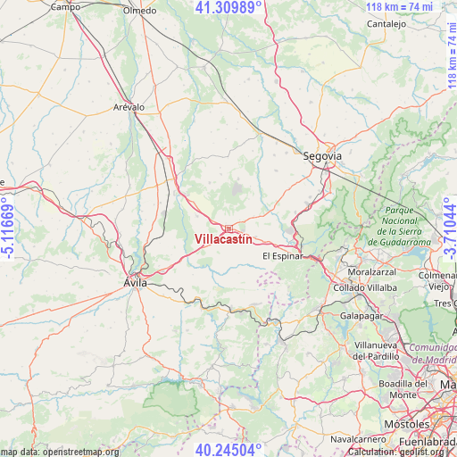
Villacastín GPS coordinates[2]
40° 46' 46.56" North, 4° 24' 48.852" West
| Map corner | latitude | longitude |
|---|---|---|
| Upper-left | 41.30989°, | -5.11669° |
| Center: | 40.7796°, | -4.41357° |
| Lower-right: | 40.24504°, | -3.71044° |
| Map W x H: | 118.4×118.4 km | = 73.6×73.6mi |
| max Lat: | 43.74134° ⇑56.6% North |
| Villacastín: | 40.7796° |
| min Lat: | ⇓43.4% South 27.64134° |
| min Long | Villacastín | max Long |
| -18.00367° | -4.41357° | 4.2899° |
| W 34.9%⇐ | ⇒65.1% E |
Elevation
Elevation of Villacastín is 1103 m = 3619 ft, and this is 505 m = 1657 ft above average elevation for this country.
| Max E: |
1682 m = 5518 ft | 6.6% |
| Villacastín | 1103 m 3619 ft | |
| Avg. | 598 m = 1962 ft | |
Min E: |
0 m = 0 ft | 93.4% |
See also: Spain elevation on elevation.city.
Geographical zone
Villacastín is located in North temperate zone (between Tropic of Cancer and the Arctic Circle). Distance of this Northern Tropic circle is 1928.3 km =1198.2 mi to South.| Distance of | km | miles | from Villacastín |
|---|---|---|---|
| North Pole | 5472.8 | 3400.6 | to North |
| Arctic Circle | 2866.9 | 1781.4 | to North |
| Tropic Cancer | 1928.3 | 1198.2 | to South |
| Equator | 4534.3 | 2817.5 | to South |


Nearby cities:
15 places around Villacastín: (largest is in red/bold)
• Bercial
14.3 km =8.9 mi,  352°
352°
• Ituero y Lama
3.7 km =2.3 mi,  51°
51°
• Labajos
11.4 km =7.1 mi,  308°
308°
• Lastras del Pozo
12.4 km =7.7 mi,  26°
26°
• Los Ángeles de San Rafael
16.7 km =10.4 mi,  90°
90°
• Maello
8.9 km =5.5 mi,  291°
291°
• Marugán
13.6 km =8.5 mi,  10°
10°
• Mediana de Voltoya
15.4 km =9.6 mi,  235°
235°
• Monterrubio
9.4 km =5.8 mi, 34°
• Muñopedro
13 km =8.1 mi,  337°
337°
• Ojos-Albos
11.9 km =7.4 mi,  226°
226°
• Tolbaños
14.5 km =9 mi,  257°
257°
• Valdeprados
13.8 km =8.6 mi,  72°
72°
• Vegas de Matute
11.6 km =7.2 mi,  81°
81°
• Zarzuela del Monte
7.3 km =4.5 mi,  63°
63°
Sources, notices
• [Note1] Compared only with cities in Spain existing in our database
• [Src1] Map data: © OpenStreetMap contributors (CC-BY-SA)
• [Src2] Other city data from geonames.org with taken over terms of usage.
• [Src3] Geographical zone / Annual Mean Temperature by Robert A. Rohde @ Wikipedia
