Ituero y Lama geodata
Ituero y Lama (Castille and León) is a seat of a third-order administrative division; located in Spain in Europe/Madrid (GMT+2) time zone. With population of 112 people, there are 5795 cities with bigger population in this country. Compared to other cities in Spain, 56.2% of cities are located further ↑North; 64.7% of cities are located further →East and 88.6% of cities have lower elevation than Ituero y Lama. Note1
Administrative division(s):
- Level 1: Castille and León
- Level 2: Provincia de Segovia
- Level 3: Ituero y Lama


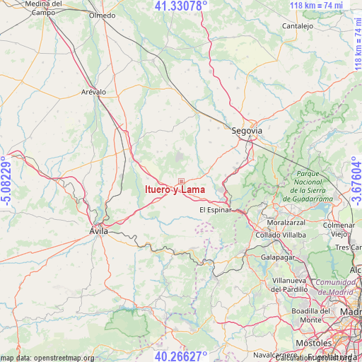
Ituero y Lama GPS coordinates[2]
40° 48' 2.376" North, 4° 22' 45.012" West
| Map corner | latitude | longitude |
|---|---|---|
| Upper-left | 41.33078°, | -5.08229° |
| Center: | 40.80066°, | -4.37917° |
| Lower-right: | 40.26627°, | -3.67604° |
| Map W x H: | 118.4×118.4 km | = 73.6×73.6mi |
| max Lat: | 43.74134° ⇑56.2% North |
| Ituero y Lama: | 40.80066° |
| min Lat: | ⇓43.8% South 27.64134° |
| min Long | Ituero y Lama | max Long |
| -18.00367° | -4.37917° | 4.2899° |
| W 35.3%⇐ | ⇒64.7% E |
Elevation
Elevation of Ituero y Lama is 1007 m = 3304 ft, and this is 409 m = 1342 ft above average elevation for this country.
| Max E: |
1682 m = 5518 ft | 11.4% |
| Ituero y Lama | 1007 m 3304 ft | |
| Avg. | 598 m = 1962 ft | |
Min E: |
0 m = 0 ft | 88.6% |
See also: Spain elevation on elevation.city.
Geographical zone
Ituero y Lama is located in North temperate zone (between Tropic of Cancer and the Arctic Circle). Distance of this Northern Tropic circle is 1930.7 km =1199.7 mi to South.| Distance of | km | miles | from Ituero y Lama |
|---|---|---|---|
| North Pole | 5470.5 | 3399.2 | to North |
| Arctic Circle | 2864.6 | 1780 | to North |
| Tropic Cancer | 1930.7 | 1199.7 | to South |
| Equator | 4536.6 | 2818.9 | to South |


Nearby cities:
15 places around Ituero y Lama: (largest is in red/bold)
• Abades
15.8 km =9.8 mi,  35°
35°
• Bercial
12.8 km =8 mi,  337°
337°
• Labajos
12.8 km =8 mi,  291°
291°
• Lastras del Pozo
9.2 km =5.7 mi,  17°
17°
• Los Ángeles de San Rafael
14.1 km =8.8 mi,  100°
100°
• Maello
11.2 km =7 mi,  274°
274°
• Marugán
11 km =6.8 mi,  357°
357°
• Monterrubio
5.9 km =3.7 mi, 24°
• Muñopedro
12.5 km =7.8 mi,  321°
321°
• Ojos-Albos
15.6 km =9.7 mi,  227°
227°
• Otero de Herreros
14.4 km =8.9 mi,  81°
81°
• Valdeprados
10.4 km =6.5 mi, 79°
• Vegas de Matute
8.6 km =5.3 mi,  94°
94°
• Villacastín
3.7 km =2.3 mi, 231°
• Zarzuela del Monte
3.7 km =2.3 mi, 75°
Sources, notices
• [Note1] Compared only with cities in Spain existing in our database
• [Src1] Map data: © OpenStreetMap contributors (CC-BY-SA)
• [Src2] Other city data from geonames.org with taken over terms of usage.
• [Src3] Geographical zone / Annual Mean Temperature by Robert A. Rohde @ Wikipedia
