Valtiendas geodata
Valtiendas (Castille and León) is a seat of a third-order administrative division; located in Spain in Europe/Madrid (GMT+2) time zone. With population of 157 people, there are 5369 cities with bigger population in this country. Compared to other cities in Spain, 60.3% of cities are located further ↓South; 58.5% of cities are located further →East and 81.8% of cities have lower elevation than Valtiendas. Note1
Administrative division(s):
- Level 1: Castille and León
- Level 2: Provincia de Segovia
- Level 3: Valtiendas


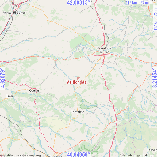
Valtiendas GPS coordinates[2]
41° 28' 42.636" North, 3° 55' 3.576" West
| Map corner | latitude | longitude |
|---|---|---|
| Upper-left | 42.00315°, | -4.62079° |
| Center: | 41.47851°, | -3.91766° |
| Lower-right: | 40.94959°, | -3.21454° |
| Map W x H: | 117.1×117.1 km | = 72.8×72.8mi |
| max Lat: | 43.74134° ⇑39.7% North |
| Valtiendas: | 41.47851° |
| min Lat: | ⇓60.3% South 27.64134° |
| min Long | Valtiendas | max Long |
| -18.00367° | -3.91766° | 4.2899° |
| W 41.5%⇐ | ⇒58.5% E |
Elevation
Elevation of Valtiendas is 914 m = 2999 ft, and this is 316 m = 1037 ft above average elevation for this country.
| Max E: |
1682 m = 5518 ft | 18.2% |
| Valtiendas | 914 m 2999 ft | |
| Avg. | 598 m = 1962 ft | |
Min E: |
0 m = 0 ft | 81.8% |
See also: Spain elevation on elevation.city.
Geographical zone
Valtiendas is located in North temperate zone (between Tropic of Cancer and the Arctic Circle). Distance of this Northern Tropic circle is 2006.1 km =1246.5 mi to South.| Distance of | km | miles | from Valtiendas |
|---|---|---|---|
| North Pole | 5395.1 | 3352.4 | to North |
| Arctic Circle | 2789.2 | 1733.1 | to North |
| Tropic Cancer | 2006.1 | 1246.5 | to South |
| Equator | 4612 | 2865.8 | to South |


Nearby cities:
15 places around Valtiendas: (largest is in red/bold)
• Aldeasoña
11.6 km =7.2 mi,  266°
266°
• Carrascal del Río
12.4 km =7.7 mi,  172°
172°
• Castro de Fuentidueña
8.3 km =5.2 mi,  141°
141°
• Castrojimeno
10.8 km =6.7 mi,  147°
147°
• Castroserracín
13.5 km =8.4 mi,  134°
134°
• Cobos de Fuentidueña
10.7 km =6.6 mi,  184°
184°
• Cuevas de Provanco
8 km =5 mi,  332°
332°
• Fuente el Olmo de Fuentidueña
13 km =8.1 mi,  212°
212°
• Fuentesaúco de Fuentidueña
13.5 km =8.4 mi,  243°
243°
• Fuentesoto
2.4 km =1.5 mi, 181°
• Fuentidueña
6.5 km =4 mi,  231°
231°
• Laguna de Contreras
9.4 km =5.8 mi,  281°
281°
• Moradillo de Roa
13.3 km =8.3 mi,  52°
52°
• Sacramenia
4.1 km =2.5 mi,  295°
295°
• Torreadrada
7.5 km =4.7 mi,  120°
120°
Sources, notices
• [Note1] Compared only with cities in Spain existing in our database
• [Src1] Map data: © OpenStreetMap contributors (CC-BY-SA)
• [Src2] Other city data from geonames.org with taken over terms of usage.
• [Src3] Geographical zone / Annual Mean Temperature by Robert A. Rohde @ Wikipedia
