Fuente el Olmo de Fuentidueña geodata
Fuente el Olmo de Fuentidueña (Castille and León) is a seat of a third-order administrative division; located in Spain in Europe/Madrid (GMT+2) time zone. With population of 117 people, there are 5732 cities with bigger population in this country. Compared to other cities in Spain, 57% of cities are located further ↓South; 59.7% of cities are located further →East and 75% of cities have lower elevation than Fuente el Olmo de Fuentidueña. Note1
Administrative division(s):
- Level 1: Castille and León
- Level 2: Provincia de Segovia
- Level 3: Fuente el Olmo de Fuentidueña
Current local time in Fuente el Olmo de Fuentidueña:
11:59 PM, ThursdayDifference from your time zone: hours


Fuente el Olmo de Fuentidueña GPS coordinates[2]
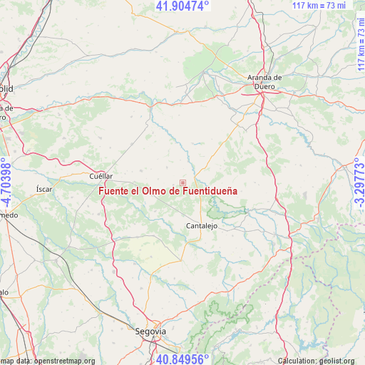
41° 22' 45.444" North, 4° 0' 3.096" West
| Map corner | latitude | longitude |
|---|---|---|
| Upper-left | 41.90474°, | -4.70398° |
| Center: | 41.37929°, | -4.00086° |
| Lower-right: | 40.84956°, | -3.29773° |
| Map W x H: | 117.3×117.3 km | = 72.9×72.9mi |
| max Lat: | 43.74134° ⇑43% North |
| Fuente el Olmo de Fuentidueña: | 41.37929° |
| min Lat: | ⇓57% South 27.64134° |
| min Long | Fuente el Olmo | max Long |
| -18.00367° | -4.00086° | 4.2899° |
| W 40.3%⇐ | ⇒59.7% E |
Elevation
Elevation of Fuente el Olmo de Fuentidueña is 851 m = 2792 ft, and this is 253 m = 830 ft above average elevation for this country.
| Max E: |
1682 m = 5518 ft | 25% |
| Fuente el Olmo de Fuentidueña | 851 m 2792 ft | |
| Avg. | 598 m = 1962 ft | |
Min E: |
0 m = 0 ft | 75% |
See also: Spain elevation on elevation.city.
Geographical zone
Fuente el Olmo de Fuentidueña is located in North temperate zone (between Tropic of Cancer and the Arctic Circle). Distance of this Northern Tropic circle is 1995 km =1239.6 mi to South.| Distance of | km | miles | from Fuente el Olmo de Fuentidueña |
|---|---|---|---|
| North Pole | 5406.1 | 3359.2 | to North |
| Arctic Circle | 2800.2 | 1740 | to North |
| Tropic Cancer | 1995 | 1239.6 | to South |
| Equator | 4600.9 | 2858.9 | to South |


Nearby cities:
15 places around Fuente el Olmo de Fuentidueña: (largest is in red/bold)
• Adrados
9.3 km =5.8 mi,  262°
262°
• Aldeasoña
11.4 km =7.1 mi,  335°
335°
• Carrascal del Río
8.7 km =5.4 mi,  98°
98°
• Cobos de Fuentidueña
6.2 km =3.9 mi,  86°
86°
• Cozuelos de Fuentidueña
8 km =5 mi,  279°
279°
• Fuentepiñel
4.1 km =2.5 mi,  301°
301°
• Fuentesaúco de Fuentidueña
7.2 km =4.5 mi,  314°
314°
• Fuentesoto
11 km =6.8 mi,  38°
38°
• Fuentidueña
7.2 km =4.5 mi,  14°
14°
• Hontalbilla
10.7 km =6.6 mi,  249°
249°
• Lastras de Cuéllar
12.7 km =7.9 mi,  224°
224°
• Membibre de la Hoz
11.1 km =6.9 mi, 314°
• Navalilla
7.1 km =4.4 mi,  126°
126°
• Perosillo
11.8 km =7.3 mi, 277°
• Torrecilla del Pinar
3.2 km =2 mi, 258°
Sources, notices
• [Note1] Compared only with cities in Spain existing in our database
• [Src1] Map data: © OpenStreetMap contributors (CC-BY-SA)
• [Src2] Other city data from geonames.org with taken over terms of usage.
• [Src3] Geographical zone / Annual Mean Temperature by Robert A. Rohde @ Wikipedia
