Torreadrada geodata
Torreadrada (Castille and León) is a seat of a third-order administrative division; located in Spain in Europe/Madrid (GMT+2) time zone. With population of 113 people, there are 5780 cities with bigger population in this country. Compared to other cities in Spain, 59.4% of cities are located further ↓South; 57.4% of cities are located further →East and 92.5% of cities have lower elevation than Torreadrada. Note1
Administrative division(s):
- Level 1: Castille and León
- Level 2: Provincia de Segovia
- Level 3: Torreadrada


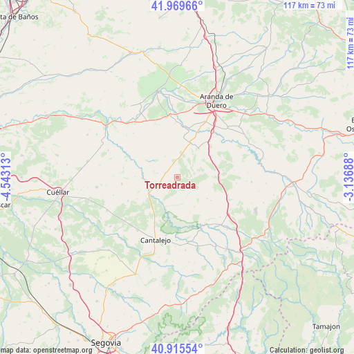
Torreadrada GPS coordinates[2]
41° 26' 41.064" North, 3° 50' 24" West
| Map corner | latitude | longitude |
|---|---|---|
| Upper-left | 41.96966°, | -4.54313° |
| Center: | 41.44474°, | -3.84° |
| Lower-right: | 40.91554°, | -3.13688° |
| Map W x H: | 117.2×117.2 km | = 72.8×72.8mi |
| max Lat: | 43.74134° ⇑40.6% North |
| Torreadrada: | 41.44474° |
| min Lat: | ⇓59.4% South 27.64134° |
| min Long | Torreadrada | max Long |
| -18.00367° | -3.84° | 4.2899° |
| W 42.6%⇐ | ⇒57.4% E |
Elevation
Elevation of Torreadrada is 1082 m = 3550 ft, and this is 484 m = 1588 ft above average elevation for this country.
| Max E: |
1682 m = 5518 ft | 7.5% |
| Torreadrada | 1082 m 3550 ft | |
| Avg. | 598 m = 1962 ft | |
Min E: |
0 m = 0 ft | 92.5% |
See also: Spain elevation on elevation.city.
Geographical zone
Torreadrada is located in North temperate zone (between Tropic of Cancer and the Arctic Circle). Distance of this Northern Tropic circle is 2002.3 km =1244.2 mi to South.| Distance of | km | miles | from Torreadrada |
|---|---|---|---|
| North Pole | 5398.8 | 3354.7 | to North |
| Arctic Circle | 2793 | 1735.5 | to North |
| Tropic Cancer | 2002.3 | 1244.2 | to South |
| Equator | 4608.2 | 2863.4 | to South |


Nearby cities:
15 places around Torreadrada: (largest is in red/bold)
• Carrascal del Río
9.8 km =6.1 mi,  209°
209°
• Castro de Fuentidueña
3 km =1.9 mi, 205°
• Castrojimeno
5.4 km =3.4 mi,  186°
186°
• Castroserracín
6.5 km =4 mi,  150°
150°
• Cobos de Fuentidueña
10 km =6.2 mi,  226°
226°
• Fuentenebro
11.7 km =7.3 mi,  37°
37°
• Fuentesoto
6.7 km =4.2 mi,  281°
281°
• Fuentidueña
11.6 km =7.2 mi,  268°
268°
• Navares de Enmedio
12.1 km =7.5 mi,  125°
125°
• Navares de las Cuevas
8.2 km =5.1 mi,  114°
114°
• Pradales
11.1 km =6.9 mi,  83°
83°
• Sacramenia
11.6 km =7.2 mi,  298°
298°
• Urueñas
11.3 km =7 mi, 150°
• Valle de Tabladillo
9.1 km =5.7 mi,  179°
179°
• Valtiendas
7.5 km =4.7 mi, 300°
Sources, notices
• [Note1] Compared only with cities in Spain existing in our database
• [Src1] Map data: © OpenStreetMap contributors (CC-BY-SA)
• [Src2] Other city data from geonames.org with taken over terms of usage.
• [Src3] Geographical zone / Annual Mean Temperature by Robert A. Rohde @ Wikipedia
