Valle de Tabladillo geodata
Valle de Tabladillo (Castille and León) is a seat of a third-order administrative division; located in Spain in Europe/Madrid (GMT+2) time zone. With population of 144 people, there are 5470 cities with bigger population in this country. Compared to other cities in Spain, 56.5% of cities are located further ↓South; 57.4% of cities are located further →East and 84.4% of cities have lower elevation than Valle de Tabladillo. Note1
Administrative division(s):
- Level 1: Castille and León
- Level 2: Provincia de Segovia
- Level 3: Valle de Tabladillo


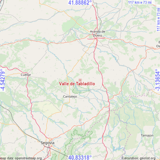
Valle de Tabladillo GPS coordinates[2]
41° 21' 46.944" North, 3° 50' 22.776" West
| Map corner | latitude | longitude |
|---|---|---|
| Upper-left | 41.88862°, | -4.54279° |
| Center: | 41.36304°, | -3.83966° |
| Lower-right: | 40.83318°, | -3.13654° |
| Map W x H: | 117.4×117.4 km | = 72.9×72.9mi |
| max Lat: | 43.74134° ⇑43.5% North |
| Valle de Tabladillo: | 41.36304° |
| min Lat: | ⇓56.5% South 27.64134° |
| min Long | Valle de Tablad | max Long |
| -18.00367° | -3.83966° | 4.2899° |
| W 42.6%⇐ | ⇒57.4% E |
Elevation
Elevation of Valle de Tabladillo is 944 m = 3097 ft, and this is 346 m = 1135 ft above average elevation for this country.
| Max E: |
1682 m = 5518 ft | 15.6% |
| Valle de Tabladillo | 944 m 3097 ft | |
| Avg. | 598 m = 1962 ft | |
Min E: |
0 m = 0 ft | 84.4% |
See also: Spain elevation on elevation.city.
Geographical zone
Valle de Tabladillo is located in North temperate zone (between Tropic of Cancer and the Arctic Circle). Distance of this Northern Tropic circle is 1993.2 km =1238.5 mi to South.| Distance of | km | miles | from Valle de Tabladillo |
|---|---|---|---|
| North Pole | 5407.9 | 3360.3 | to North |
| Arctic Circle | 2802 | 1741.1 | to North |
| Tropic Cancer | 1993.2 | 1238.5 | to South |
| Equator | 4599.1 | 2857.7 | to South |


Nearby cities:
15 places around Valle de Tabladillo: (largest is in red/bold)
• Aldeonte
13.5 km =8.4 mi,  95°
95°
• Carrascal del Río
4.9 km =3 mi,  276°
276°
• Castro de Fuentidueña
6.5 km =4 mi,  348°
348°
• Castrojimeno
3.8 km =2.4 mi, 350°
• Castroserracín
4.6 km =2.9 mi,  43°
43°
• Cobos de Fuentidueña
7.6 km =4.7 mi,  286°
286°
• Fuentesoto
12.3 km =7.6 mi,  327°
327°
• Navalilla
8.1 km =5 mi,  252°
252°
• Navares de Ayuso
11.1 km =6.9 mi,  83°
83°
• Navares de Enmedio
9.9 km =6.2 mi, 78°
• Navares de las Cuevas
9.4 km =5.8 mi,  52°
52°
• Sebúlcor
10.9 km =6.8 mi,  199°
199°
• Sepúlveda
11 km =6.8 mi,  132°
132°
• Torreadrada
9.1 km =5.7 mi,  359°
359°
• Urueñas
5.5 km =3.4 mi, 98°
Sources, notices
• [Note1] Compared only with cities in Spain existing in our database
• [Src1] Map data: © OpenStreetMap contributors (CC-BY-SA)
• [Src2] Other city data from geonames.org with taken over terms of usage.
• [Src3] Geographical zone / Annual Mean Temperature by Robert A. Rohde @ Wikipedia
