San Pedro Bercianos geodata
San Pedro Bercianos (Castille and León) is a seat of a third-order administrative division; located in Spain in Europe/Madrid (GMT+2) time zone. With population of 337 people, there are 4364 cities with bigger population in this country. Compared to other cities in Spain, 84.5% of cities are located further ↓South; 81.9% of cities are located further →East and 71.2% of cities have lower elevation than San Pedro Bercianos. Note1
Administrative division(s):
- Level 1: Castille and León
- Level 2: Provincia de León
- Level 3: San Pedro Bercianos


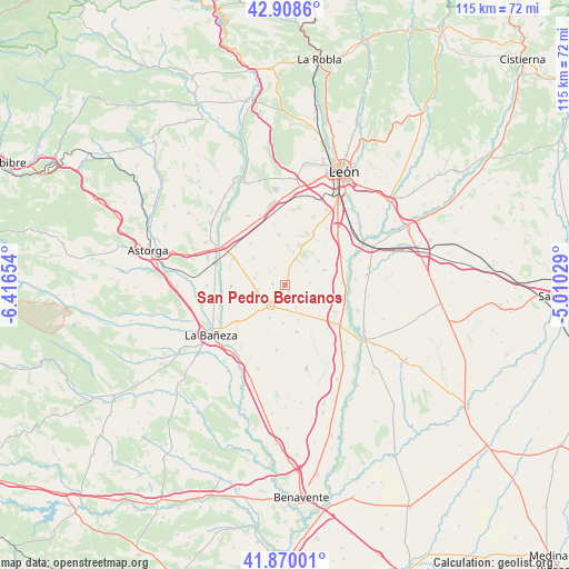
San Pedro Bercianos GPS coordinates[2]
42° 23' 29.22" North, 5° 42' 48.276" West
| Map corner | latitude | longitude |
|---|---|---|
| Upper-left | 42.9086°, | -6.41654° |
| Center: | 42.39145°, | -5.71341° |
| Lower-right: | 41.87001°, | -5.01029° |
| Map W x H: | 115.5×115.5 km | = 71.8×71.8mi |
| max Lat: | 43.74134° ⇑15.5% North |
| San Pedro Bercianos: | 42.39145° |
| min Lat: | ⇓84.5% South 27.64134° |
| min Long | San Pedro Berci | max Long |
| -18.00367° | -5.71341° | 4.2899° |
| W 18.1%⇐ | ⇒81.9% E |
Elevation
Elevation of San Pedro Bercianos is 822 m = 2697 ft, and this is 224 m = 735 ft above average elevation for this country.
| Max E: |
1682 m = 5518 ft | 28.8% |
| San Pedro Bercianos | 822 m 2697 ft | |
| Avg. | 598 m = 1962 ft | |
Min E: |
0 m = 0 ft | 71.2% |
See also: Spain elevation on elevation.city.
Geographical zone
San Pedro Bercianos is located in North temperate zone (between Tropic of Cancer and the Arctic Circle). Distance of this Northern Tropic circle is 2107.6 km =1309.6 mi to South.| Distance of | km | miles | from San Pedro Bercianos |
|---|---|---|---|
| North Pole | 5293.6 | 3289.3 | to North |
| Arctic Circle | 2687.7 | 1670.1 | to North |
| Tropic Cancer | 2107.6 | 1309.6 | to South |
| Equator | 4713.5 | 2928.8 | to South |


Nearby cities:
15 places around San Pedro Bercianos: (largest is in red/bold)
• Ardón
13.5 km =8.4 mi,  68°
68°
• Bercianos del Páramo
1.3 km =0.8 mi,  161°
161°
• Bustillo del Páramo
8.6 km =5.3 mi,  310°
310°
• Cabreros del Río
14.2 km =8.8 mi,  85°
85°
• Chozas de Abajo
13 km =8.1 mi,  9°
9°
• Laguna Dalga
7.3 km =4.5 mi,  205°
205°
• Pobladura de Pelayo García
9.8 km =6.1 mi,  166°
166°
• Santa María del Páramo
5.1 km =3.2 mi,  217°
217°
• Urdiales del Páramo
5.4 km =3.4 mi,  244°
244°
• Valdefuentes del Páramo
12.2 km =7.6 mi,  232°
232°
• Valdevimbre
8.3 km =5.2 mi, 67°
• Villadangos del Páramo
14.6 km =9.1 mi,  342°
342°
• Villamañán
13.3 km =8.3 mi,  125°
125°
• Villazala
12.2 km =7.6 mi,  254°
254°
• Zotes del Páramo
13.3 km =8.3 mi,  188°
188°
Sources, notices
• [Note1] Compared only with cities in Spain existing in our database
• [Src1] Map data: © OpenStreetMap contributors (CC-BY-SA)
• [Src2] Other city data from geonames.org with taken over terms of usage.
• [Src3] Geographical zone / Annual Mean Temperature by Robert A. Rohde @ Wikipedia
