Sant Feliu de Pallerols geodata
Sant Feliu de Pallerols (Catalonia) is a seat of a third-order administrative division; located in Spain in Europe/Madrid (GMT+2) time zone. In our database, there are 6762 cities with bigger population. Compared to other cities in Spain, 75.9% of cities are located further ↓South; 96.5% of cities are located further ←West and 64.4% of cities have higher elevation than Sant Feliu de Pallerols. Note1
Administrative division(s):
- Level 1: Catalonia
- Level 2: Província de Girona
- Level 3: Sant Feliu de Pallerols
Current local time in Sant Feliu de Pallerols:
10:49 PM, ThursdayDifference from your time zone: hours


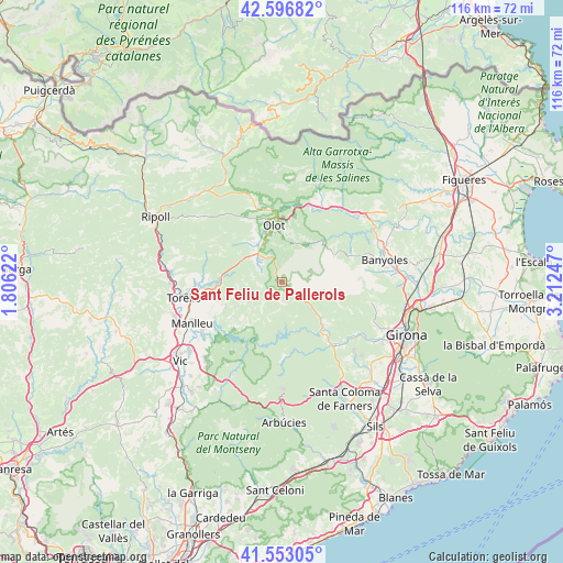
Sant Feliu de Pallerols GPS coordinates[2]
42° 4' 37.488" North, 2° 30' 33.66" East
| Map corner | latitude | longitude |
|---|---|---|
| Upper-left | 42.59682°, | 1.80622° |
| Center: | 42.07708°, | 2.50935° |
| Lower-right: | 41.55305°, | 3.21247° |
| Map W x H: | 116.1×116.1 km | = 72.1×72.1mi |
| max Lat: | 43.74134° ⇑24.1% North |
| Sant Feliu de Pallerols: | 42.07708° |
| min Lat: | ⇓75.9% South 27.64134° |
| min Long | Sant Feliu de P | max Long |
| -18.00367° | 2.50935° | 4.2899° |
| W 96.5%⇐ | ⇒3.5% E |
Elevation
Elevation of Sant Feliu de Pallerols is 467 m = 1532 ft, and this is 131 m = 430 ft below average elevation for this country.
| Max E: |
1682 m = 5518 ft | 64.4% |
| Avg. | 598 m = 1962 ft | |
| Sant Feliu de Pallerols | 467 m = 1532 ft | |
Min E: |
0 m = 0 ft | 35.6% |
See also: Spain elevation on elevation.city.
Geographical zone
Sant Feliu de Pallerols is located in North temperate zone (between Tropic of Cancer and the Arctic Circle). Distance of this Northern Tropic circle is 2072.6 km =1287.9 mi to South.| Distance of | km | miles | from Sant Feliu de Pallerols |
|---|---|---|---|
| North Pole | 5328.5 | 3311 | to North |
| Arctic Circle | 2722.6 | 1691.7 | to North |
| Tropic Cancer | 2072.6 | 1287.9 | to South |
| Equator | 4678.5 | 2907.1 | to South |


Nearby cities:
15 places around Sant Feliu de Pallerols: (largest is in red/bold)
• Mieres
11.8 km =7.3 mi,  64°
64°
• Olot
11.7 km =7.3 mi,  352°
352°
• Sant Aniol de Finestres
6.6 km =4.1 mi,  77°
77°
• Sant Cristòfol de les Fonts
10.3 km =6.4 mi,  355°
355°
• Sant Esteve d'en Bas
6.3 km =3.9 mi,  316°
316°
• Sant Joan les Fonts
15 km =9.3 mi,  1°
1°
• Sant Privat d'en Bas
11.6 km =7.2 mi,  314°
314°
• Santa Maria de Corcó
12.7 km =7.9 mi,  247°
247°
• Santa Pau
9.1 km =5.7 mi,  34°
34°
• Susqueda
11.1 km =6.9 mi,  176°
176°
• Tavertet
11.7 km =7.3 mi,  219°
219°
• la Canya
14.3 km =8.9 mi, 355°
• la Cellera de Ter
15.3 km =9.5 mi,  141°
141°
• les Planes d'Hostoles
3.5 km =2.2 mi,  131°
131°
• les Preses
8.6 km =5.3 mi,  331°
331°
Sources, notices
• [Note1] Compared only with cities in Spain existing in our database
• [Src1] Map data: © OpenStreetMap contributors (CC-BY-SA)
• [Src2] Other city data from geonames.org with taken over terms of usage.
• [Src3] Geographical zone / Annual Mean Temperature by Robert A. Rohde @ Wikipedia
