Santa Pau geodata
Santa Pau (Catalonia) is a seat of a third-order administrative division; located in Spain in Europe/Madrid (GMT+2) time zone. With population of 1,541 people, there are 2431 cities with bigger population in this country. Compared to other cities in Spain, 77.7% of cities are located further ↓South; 96.8% of cities are located further ←West and 62.8% of cities have higher elevation than Santa Pau. Note1


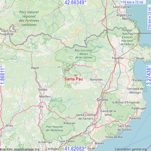
Santa Pau GPS coordinates[2]
42° 8' 39.48" North, 2° 34' 16.428" East
| Map corner | latitude | longitude |
|---|---|---|
| Upper-left | 42.66349°, | 1.86811° |
| Center: | 42.1443°, | 2.57123° |
| Lower-right: | 41.62082°, | 3.27436° |
| Map W x H: | 115.9×115.9 km | = 72×72mi |
| max Lat: | 43.74134° ⇑22.3% North |
| Santa Pau: | 42.1443° |
| min Lat: | ⇓77.7% South 27.64134° |
| min Long | Santa Pau | max Long |
| -18.00367° | 2.57123° | 4.2899° |
| W 96.8%⇐ | ⇒3.2% E |
Elevation
Elevation of Santa Pau is 489 m = 1604 ft, and this is 109 m = 358 ft below average elevation for this country.
| Max E: |
1682 m = 5518 ft | 62.8% |
| Avg. | 598 m = 1962 ft | |
| Santa Pau | 489 m = 1604 ft | |
Min E: |
0 m = 0 ft | 37.2% |
See also: Spain elevation on elevation.city.
Geographical zone
Santa Pau is located in North temperate zone (between Tropic of Cancer and the Arctic Circle). Distance of this Northern Tropic circle is 2080.1 km =1292.5 mi to South.| Distance of | km | miles | from Santa Pau |
|---|---|---|---|
| North Pole | 5321.1 | 3306.4 | to North |
| Arctic Circle | 2715.2 | 1687.1 | to North |
| Tropic Cancer | 2080.1 | 1292.5 | to South |
| Equator | 4686 | 2911.7 | to South |


Nearby cities:
15 places around Santa Pau: (largest is in red/bold)
• Argelaguer
9.8 km =6.1 mi,  36°
36°
• Castellfollit de la Roca
8.6 km =5.3 mi,  347°
347°
• Mieres
6.1 km =3.8 mi,  113°
113°
• Montagut
9.8 km =6.1 mi,  12°
12°
• Olot
7.8 km =4.8 mi,  301°
301°
• Sant Aniol de Finestres
6.1 km =3.8 mi,  167°
167°
• Sant Cristòfol de les Fonts
6.6 km =4.1 mi, 295°
• Sant Esteve d'en Bas
9.9 km =6.2 mi,  252°
252°
• Sant Feliu de Pallerols
9.1 km =5.7 mi,  214°
214°
• Sant Ferriol
10 km =6.2 mi,  51°
51°
• Sant Jaume de Llierca
8.9 km =5.5 mi,  24°
24°
• Sant Joan les Fonts
8.9 km =5.5 mi,  327°
327°
• Sant Miquel de Campmajor
9.3 km =5.8 mi,  97°
97°
• la Canya
9.1 km =5.7 mi,  317°
317°
• les Preses
9.1 km =5.7 mi,  270°
270°
Sources, notices
• [Note1] Compared only with cities in Spain existing in our database
• [Src1] Map data: © OpenStreetMap contributors (CC-BY-SA)
• [Src2] Other city data from geonames.org with taken over terms of usage.
• [Src3] Geographical zone / Annual Mean Temperature by Robert A. Rohde @ Wikipedia
