San Bartolomé de Pinares geodata
San Bartolomé de Pinares (Castille and León) is a populated place; located in Spain in Europe/Madrid (GMT+2) time zone. With population of 693 people, there are 3415 cities with bigger population in this country. Compared to other cities in Spain, 61% of cities are located further ↑North; 66.7% of cities are located further →East and 90.9% of cities have lower elevation than San Bartolomé de Pinares. Note1
Administrative division(s):
- Level 1: Castille and León
- Level 2: Provincia de Ávila
- Level 3: Tornadizos de Ávila
Current local time in San Bartolomé de Pinares:
11:08 PM, ThursdayDifference from your time zone: hours


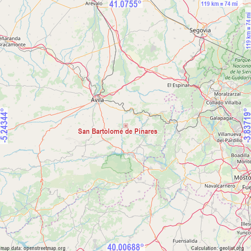
San Bartolomé de Pinares GPS coordinates[2]
40° 32' 35.952" North, 4° 32' 25.116" West
| Map corner | latitude | longitude |
|---|---|---|
| Upper-left | 41.0755°, | -5.24344° |
| Center: | 40.54332°, | -4.54031° |
| Lower-right: | 40.00688°, | -3.83719° |
| Map W x H: | 118.8×118.8 km | = 73.8×73.8mi |
| max Lat: | 43.74134° ⇑61% North |
| San Bartolomé de Pinares: | 40.54332° |
| min Lat: | ⇓39% South 27.64134° |
| min Long | San Bartolomé | max Long |
| -18.00367° | -4.54031° | 4.2899° |
| W 33.3%⇐ | ⇒66.7% E |
Elevation
Elevation of San Bartolomé de Pinares is 1047 m = 3435 ft, and this is 449 m = 1473 ft above average elevation for this country.
| Max E: |
1682 m = 5518 ft | 9.1% |
| San Bartolomé de Pinares | 1047 m 3435 ft | |
| Avg. | 598 m = 1962 ft | |
Min E: |
0 m = 0 ft | 90.9% |
See also: Spain elevation on elevation.city.
Geographical zone
San Bartolomé de Pinares is located in North temperate zone (between Tropic of Cancer and the Arctic Circle). Distance of this Northern Tropic circle is 1902.1 km =1181.9 mi to South.| Distance of | km | miles | from San Bartolomé de Pinares |
|---|---|---|---|
| North Pole | 5499.1 | 3417 | to North |
| Arctic Circle | 2893.2 | 1797.8 | to North |
| Tropic Cancer | 1902.1 | 1181.9 | to South |
| Equator | 4508 | 2801.1 | to South |


Nearby cities:
15 places around San Bartolomé de Pinares: (largest is in red/bold)
• Barraco
11.5 km =7.1 mi,  229°
229°
• Berrocalejo de Aragona
17.4 km =10.8 mi,  344°
344°
• Cebreros
11.4 km =7.1 mi,  145°
145°
• El Herradón
2.9 km =1.8 mi,  326°
326°
• El Hoyo de Pinares
10.9 km =6.8 mi,  115°
115°
• El Tiemblo
14.6 km =9.1 mi,  167°
167°
• Las Navas del Marqués
18.6 km =11.6 mi,  69°
69°
• Mediana de Voltoya
17.6 km =10.9 mi,  353°
353°
• Navalperal de Pinares
12.3 km =7.6 mi,  62°
62°
• Navaluenga
20.5 km =12.7 mi,  224°
224°
• Ojos-Albos
18.2 km =11.3 mi,  6°
6°
• San Juan de la Nava
14 km =8.7 mi,  239°
239°
• Santa Cruz de Pinares
3.4 km =2.1 mi,  268°
268°
• Tornadizos de Ávila
11.3 km =7 mi, 326°
• Ávila
18.5 km =11.5 mi,  313°
313°
Sources, notices
• [Note1] Compared only with cities in Spain existing in our database
• [Src1] Map data: © OpenStreetMap contributors (CC-BY-SA)
• [Src2] Other city data from geonames.org with taken over terms of usage.
• [Src3] Geographical zone / Annual Mean Temperature by Robert A. Rohde @ Wikipedia
