El Hoyo de Pinares geodata
El Hoyo de Pinares (Castille and León) is a populated place; located in Spain in Europe/Madrid (GMT+2) time zone. With population of 2,429 people, there are 1929 cities with bigger population in this country. Compared to other cities in Spain, 61.8% of cities are located further ↑North; 65.2% of cities are located further →East and 75% of cities have lower elevation than El Hoyo de Pinares. Note1
Administrative division(s):
- Level 1: Castille and León
- Level 2: Provincia de Ávila
- Level 3: Hoyo de Pinares, El


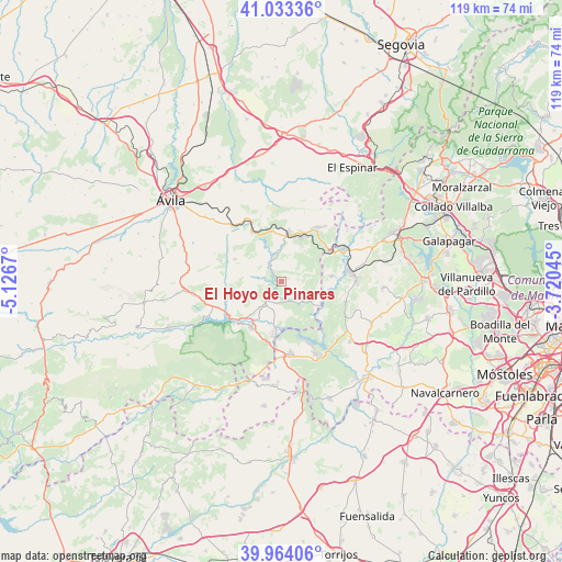
El Hoyo de Pinares GPS coordinates[2]
40° 30' 3.024" North, 4° 25' 24.852" West
| Map corner | latitude | longitude |
|---|---|---|
| Upper-left | 41.03336°, | -5.1267° |
| Center: | 40.50084°, | -4.42357° |
| Lower-right: | 39.96406°, | -3.72045° |
| Map W x H: | 118.9×118.9 km | = 73.9×73.9mi |
| max Lat: | 43.74134° ⇑61.8% North |
| El Hoyo de Pinares: | 40.50084° |
| min Lat: | ⇓38.2% South 27.64134° |
| min Long | El Hoyo de Pina | max Long |
| -18.00367° | -4.42357° | 4.2899° |
| W 34.8%⇐ | ⇒65.2% E |
Elevation
Elevation of El Hoyo de Pinares is 851 m = 2792 ft, and this is 253 m = 830 ft above average elevation for this country.
| Max E: |
1682 m = 5518 ft | 25% |
| El Hoyo de Pinares | 851 m 2792 ft | |
| Avg. | 598 m = 1962 ft | |
Min E: |
0 m = 0 ft | 75% |
See also: Spain elevation on elevation.city.
Geographical zone
El Hoyo de Pinares is located in North temperate zone (between Tropic of Cancer and the Arctic Circle). Distance of this Northern Tropic circle is 1897.4 km =1179 mi to South.| Distance of | km | miles | from El Hoyo de Pinares |
|---|---|---|---|
| North Pole | 5503.8 | 3419.9 | to North |
| Arctic Circle | 2897.9 | 1800.7 | to North |
| Tropic Cancer | 1897.4 | 1179 | to South |
| Equator | 4503.3 | 2798.2 | to South |


Nearby cities:
15 places around El Hoyo de Pinares: (largest is in red/bold)
• Barraco
18.8 km =11.7 mi,  261°
261°
• Cebreros
5.8 km =3.6 mi,  216°
216°
• El Herradón
13.5 km =8.4 mi,  301°
301°
• El Tiemblo
11.6 km =7.2 mi,  214°
214°
• Las Navas del Marqués
13.6 km =8.5 mi,  33°
33°
• Navahondilla
20.5 km =12.7 mi,  197°
197°
• Navalperal de Pinares
10.4 km =6.5 mi,  5°
5°
• Navas del Rey
19.4 km =12.1 mi,  131°
131°
• Pelayos de la Presa
17.3 km =10.7 mi,  154°
154°
• Robledo de Chavela
15.8 km =9.8 mi,  90°
90°
• San Bartolomé de Pinares
10.9 km =6.8 mi, 295°
• San Martín de Valdeiglesias
15.6 km =9.7 mi,  172°
172°
• Santa Cruz de Pinares
14 km =8.7 mi,  289°
289°
• Santa María de la Alameda
17.5 km =10.9 mi,  53°
53°
• Valdemaqueda
10.8 km =6.7 mi,  83°
83°
Sources, notices
• [Note1] Compared only with cities in Spain existing in our database
• [Src1] Map data: © OpenStreetMap contributors (CC-BY-SA)
• [Src2] Other city data from geonames.org with taken over terms of usage.
• [Src3] Geographical zone / Annual Mean Temperature by Robert A. Rohde @ Wikipedia
