Piérnigas geodata
Piérnigas (Castille and León) is a seat of a third-order administrative division; located in Spain in Europe/Madrid (GMT+2) time zone. With population of 38 people, there are 6589 cities with bigger population in this country. Compared to other cities in Spain, 89.3% of cities are located further ↓South; 50.9% of cities are located further →East and 59.2% of cities have lower elevation than Piérnigas. Note1
Administrative division(s):
- Level 1: Castille and León
- Level 2: Provincia de Burgos
- Level 3: Piérnigas


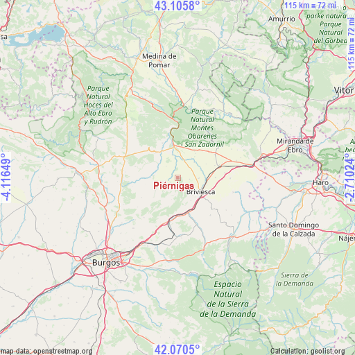
Piérnigas GPS coordinates[2]
42° 35' 25.08" North, 3° 24' 48.132" West
| Map corner | latitude | longitude |
|---|---|---|
| Upper-left | 43.1058°, | -4.11649° |
| Center: | 42.5903°, | -3.41337° |
| Lower-right: | 42.0705°, | -2.71024° |
| Map W x H: | 115.1×115.1 km | = 71.5×71.5mi |
| max Lat: | 43.74134° ⇑10.7% North |
| Piérnigas: | 42.5903° |
| min Lat: | ⇓89.3% South 27.64134° |
| min Long | Piérnigas | max Long |
| -18.00367° | -3.41337° | 4.2899° |
| W 49.1%⇐ | ⇒50.9% E |
Elevation
Elevation of Piérnigas is 739 m = 2425 ft, and this is 141 m = 463 ft above average elevation for this country.
| Max E: |
1682 m = 5518 ft | 40.8% |
| Piérnigas | 739 m 2425 ft | |
| Avg. | 598 m = 1962 ft | |
Min E: |
0 m = 0 ft | 59.2% |
See also: Spain elevation on elevation.city.
Geographical zone
Piérnigas is located in North temperate zone (between Tropic of Cancer and the Arctic Circle). Distance of this Northern Tropic circle is 2129.7 km =1323.3 mi to South.| Distance of | km | miles | from Piérnigas |
|---|---|---|---|
| North Pole | 5271.5 | 3275.6 | to North |
| Arctic Circle | 2665.6 | 1656.3 | to North |
| Tropic Cancer | 2129.7 | 1323.3 | to South |
| Equator | 4735.6 | 2942.6 | to South |


Nearby cities:
15 places around Piérnigas: (largest is in red/bold)
• Aguilar de Bureba
6.9 km =4.3 mi,  90°
90°
• Briviesca
8.6 km =5.3 mi,  121°
121°
• Carcedo de Bureba
7.1 km =4.4 mi,  259°
259°
• Castil de Peones
12.1 km =7.5 mi,  168°
168°
• Galbarros
7.3 km =4.5 mi,  196°
196°
• Grisaleña
12.2 km =7.6 mi, 89°
• Llano de Bureba
5.3 km =3.3 mi,  315°
315°
• Poza de la Sal
11 km =6.8 mi, 319°
• Prádanos de Bureba
11.1 km =6.9 mi,  151°
151°
• Quintanabureba
3.8 km =2.4 mi,  96°
96°
• Reinoso
9.3 km =5.8 mi, 165°
• Rojas
2.7 km =1.7 mi,  239°
239°
• Rublacedo de Abajo
8.4 km =5.2 mi, 240°
• Salinillas de Bureba
4.7 km =2.9 mi, 153°
• Vileña
8.2 km =5.1 mi,  64°
64°
Sources, notices
• [Note1] Compared only with cities in Spain existing in our database
• [Src1] Map data: © OpenStreetMap contributors (CC-BY-SA)
• [Src2] Other city data from geonames.org with taken over terms of usage.
• [Src3] Geographical zone / Annual Mean Temperature by Robert A. Rohde @ Wikipedia
