Recuerda geodata
Recuerda (Castille and León) is a seat of a third-order administrative division; located in Spain in Europe/Madrid (GMT+2) time zone. With population of 114 people, there are 5769 cities with bigger population in this country. Compared to other cities in Spain, 60.2% of cities are located further ↓South; 54.6% of cities are located further ←West and 80.4% of cities have lower elevation than Recuerda. Note1
Administrative division(s):
- Level 1: Castille and León
- Level 2: Provincia de Soria
- Level 3: Recuerda


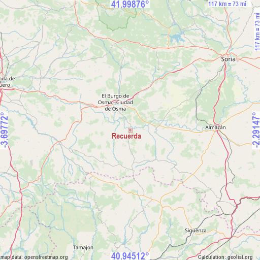
Recuerda GPS coordinates[2]
41° 28' 26.688" North, 2° 59' 40.56" West
| Map corner | latitude | longitude |
|---|---|---|
| Upper-left | 41.99876°, | -3.69772° |
| Center: | 41.47408°, | -2.9946° |
| Lower-right: | 40.94512°, | -2.29147° |
| Map W x H: | 117.2×117.2 km | = 72.8×72.8mi |
| max Lat: | 43.74134° ⇑39.8% North |
| Recuerda: | 41.47408° |
| min Lat: | ⇓60.2% South 27.64134° |
| min Long | Recuerda | max Long |
| -18.00367° | -2.9946° | 4.2899° |
| W 54.6%⇐ | ⇒45.4% E |
Elevation
Elevation of Recuerda is 901 m = 2956 ft, and this is 303 m = 994 ft above average elevation for this country.
| Max E: |
1682 m = 5518 ft | 19.6% |
| Recuerda | 901 m 2956 ft | |
| Avg. | 598 m = 1962 ft | |
Min E: |
0 m = 0 ft | 80.4% |
See also: Spain elevation on elevation.city.
Geographical zone
Recuerda is located in North temperate zone (between Tropic of Cancer and the Arctic Circle). Distance of this Northern Tropic circle is 2005.6 km =1246.2 mi to South.| Distance of | km | miles | from Recuerda |
|---|---|---|---|
| North Pole | 5395.6 | 3352.7 | to North |
| Arctic Circle | 2789.7 | 1733.4 | to North |
| Tropic Cancer | 2005.6 | 1246.2 | to South |
| Equator | 4611.5 | 2865.5 | to South |


Nearby cities:
15 places around Recuerda: (largest is in red/bold)
• Arenillas
18.8 km =11.7 mi,  138°
138°
• Bayubas de Abajo
10.1 km =6.3 mi,  54°
54°
• Bayubas de Arriba
12.9 km =8 mi,  43°
43°
• Berlanga de Duero
11.1 km =6.9 mi,  94°
94°
• Caracena
12.9 km =8 mi,  218°
218°
• Carrascosa de Abajo
9.7 km =6 mi,  234°
234°
• El Burgo de Osma
13.8 km =8.6 mi,  334°
334°
• Fresno de Caracena
8.4 km =5.2 mi,  253°
253°
• Gormaz
2.2 km =1.4 mi,  336°
336°
• Quintanas de Gormaz
4.2 km =2.6 mi,  21°
21°
• Retortillo de Soria
18.2 km =11.3 mi,  176°
176°
• Tajueco
14 km =8.7 mi,  60°
60°
• Valdenebro
11.1 km =6.9 mi,  13°
13°
• Valderrodilla
18.5 km =11.5 mi, 57°
• Villanueva de Gormaz
5.7 km =3.5 mi,  262°
262°
Sources, notices
• [Note1] Compared only with cities in Spain existing in our database
• [Src1] Map data: © OpenStreetMap contributors (CC-BY-SA)
• [Src2] Other city data from geonames.org with taken over terms of usage.
• [Src3] Geographical zone / Annual Mean Temperature by Robert A. Rohde @ Wikipedia
