Quintanas de Gormaz geodata
Quintanas de Gormaz (Castille and León) is a seat of a third-order administrative division; located in Spain in Europe/Madrid (GMT+2) time zone. With population of 196 people, there are 5065 cities with bigger population in this country. Compared to other cities in Spain, 61% of cities are located further ↓South; 54.9% of cities are located further ←West and 84.2% of cities have lower elevation than Quintanas de Gormaz. Note1
Administrative division(s):
- Level 1: Castille and León
- Level 2: Provincia de Soria
- Level 3: Quintanas de Gormaz


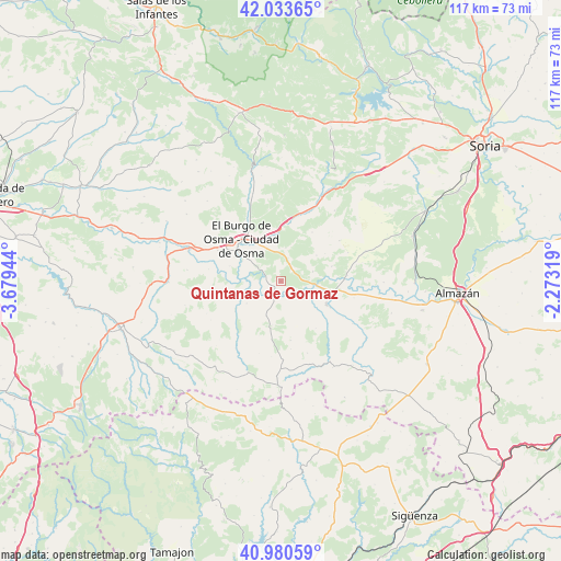
Quintanas de Gormaz GPS coordinates[2]
41° 30' 33.336" North, 2° 58' 34.716" West
| Map corner | latitude | longitude |
|---|---|---|
| Upper-left | 42.03365°, | -3.67944° |
| Center: | 41.50926°, | -2.97631° |
| Lower-right: | 40.98059°, | -2.27319° |
| Map W x H: | 117.1×117.1 km | = 72.8×72.8mi |
| max Lat: | 43.74134° ⇑39% North |
| Quintanas de Gormaz: | 41.50926° |
| min Lat: | ⇓61% South 27.64134° |
| min Long | Quintanas de Go | max Long |
| -18.00367° | -2.97631° | 4.2899° |
| W 54.9%⇐ | ⇒45.1% E |
Elevation
Elevation of Quintanas de Gormaz is 942 m = 3091 ft, and this is 344 m = 1129 ft above average elevation for this country.
| Max E: |
1682 m = 5518 ft | 15.8% |
| Quintanas de Gormaz | 942 m 3091 ft | |
| Avg. | 598 m = 1962 ft | |
Min E: |
0 m = 0 ft | 84.2% |
See also: Spain elevation on elevation.city.
Geographical zone
Quintanas de Gormaz is located in North temperate zone (between Tropic of Cancer and the Arctic Circle). Distance of this Northern Tropic circle is 2009.5 km =1248.6 mi to South.| Distance of | km | miles | from Quintanas de Gormaz |
|---|---|---|---|
| North Pole | 5391.7 | 3350.2 | to North |
| Arctic Circle | 2785.8 | 1731 | to North |
| Tropic Cancer | 2009.5 | 1248.6 | to South |
| Equator | 4615.4 | 2867.9 | to South |


Nearby cities:
15 places around Quintanas de Gormaz: (largest is in red/bold)
• Bayubas de Abajo
7 km =4.3 mi,  73°
73°
• Bayubas de Arriba
9.1 km =5.7 mi,  54°
54°
• Berlanga de Duero
10.7 km =6.6 mi,  116°
116°
• Caracena
17 km =10.6 mi,  214°
214°
• Carrascosa de Abajo
13.4 km =8.3 mi,  224°
224°
• El Burgo de Osma
11.3 km =7 mi,  319°
319°
• Fresno de Caracena
11.5 km =7.1 mi,  236°
236°
• Fuentepinilla
18.9 km =11.7 mi, 70°
• Gormaz
3 km =1.9 mi,  231°
231°
• Recuerda
4.2 km =2.6 mi,  201°
201°
• Tajueco
11.1 km =6.9 mi, 74°
• Valdemaluque
19.2 km =11.9 mi,  342°
342°
• Valdenebro
7 km =4.3 mi,  8°
8°
• Valderrodilla
15.3 km =9.5 mi, 66°
• Villanueva de Gormaz
8.5 km =5.3 mi, 236°
Sources, notices
• [Note1] Compared only with cities in Spain existing in our database
• [Src1] Map data: © OpenStreetMap contributors (CC-BY-SA)
• [Src2] Other city data from geonames.org with taken over terms of usage.
• [Src3] Geographical zone / Annual Mean Temperature by Robert A. Rohde @ Wikipedia
