Pedrola geodata
Pedrola (Aragon) is a seat of a third-order administrative division; located in Spain in Europe/Madrid (GMT+2) time zone. With population of 2,945 people, there are 1743 cities with bigger population in this country. Compared to other cities in Spain, 68.3% of cities are located further ↓South; 75.5% of cities are located further ←West and 79% of cities have higher elevation than Pedrola. Note1


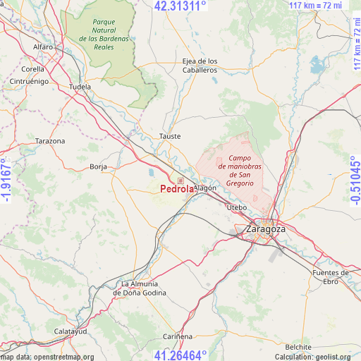
Pedrola GPS coordinates[2]
41° 47' 27.672" North, 1° 12' 48.852" West
| Map corner | latitude | longitude |
|---|---|---|
| Upper-left | 42.31311°, | -1.9167° |
| Center: | 41.79102°, | -1.21357° |
| Lower-right: | 41.26464°, | -0.51045° |
| Map W x H: | 116.6×116.6 km | = 72.5×72.5mi |
| max Lat: | 43.74134° ⇑31.7% North |
| Pedrola: | 41.79102° |
| min Lat: | ⇓68.3% South 27.64134° |
| min Long | Pedrola | max Long |
| -18.00367° | -1.21357° | 4.2899° |
| W 75.5%⇐ | ⇒24.5% E |
Elevation
Elevation of Pedrola is 238 m = 781 ft, and this is 360 m = 1181 ft below average elevation for this country.
| Max E: |
1682 m = 5518 ft | 79% |
| Avg. | 598 m = 1962 ft | |
| Pedrola | 238 m = 781 ft | |
Min E: |
0 m = 0 ft | 21% |
See also: Spain elevation on elevation.city.
Geographical zone
Pedrola is located in North temperate zone (between Tropic of Cancer and the Arctic Circle). Distance of this Northern Tropic circle is 2040.8 km =1268.1 mi to South.| Distance of | km | miles | from Pedrola |
|---|---|---|---|
| North Pole | 5360.3 | 3330.7 | to North |
| Arctic Circle | 2754.4 | 1711.5 | to North |
| Tropic Cancer | 2040.8 | 1268.1 | to South |
| Equator | 4646.7 | 2887.3 | to South |


Nearby cities:
15 places around Pedrola: (largest is in red/bold)
• Alagón
8.2 km =5.1 mi,  106°
106°
• Alcalá de Ebro
3.1 km =1.9 mi,  30°
30°
• Bardallur
11.9 km =7.4 mi,  179°
179°
• Boquiñeni
7.1 km =4.4 mi,  333°
333°
• Bárboles
9.4 km =5.8 mi,  165°
165°
• Cabañas de Ebro
1.5 km =0.9 mi,  48°
48°
• Figueruelas
4.2 km =2.6 mi,  130°
130°
• Gallur
12.1 km =7.5 mi,  315°
315°
• Grisén
6.6 km =4.1 mi,  140°
140°
• Luceni
4.7 km =2.9 mi, 333°
• Pinseque
11.2 km =7 mi,  122°
122°
• Plasencia de Jalón
12.2 km =7.6 mi,  186°
186°
• Pleitas
8.9 km =5.5 mi, 174°
• Pradilla de Ebro
8.8 km =5.5 mi, 332°
• Remolinos
6.2 km =3.9 mi, 28°
Sources, notices
• [Note1] Compared only with cities in Spain existing in our database
• [Src1] Map data: © OpenStreetMap contributors (CC-BY-SA)
• [Src2] Other city data from geonames.org with taken over terms of usage.
• [Src3] Geographical zone / Annual Mean Temperature by Robert A. Rohde @ Wikipedia
