Moneva geodata
Moneva (Aragon) is a seat of a third-order administrative division; located in Spain in Europe/Madrid (GMT+2) time zone. With population of 115 people, there are 5757 cities with bigger population in this country. Compared to other cities in Spain, 51.6% of cities are located further ↓South; 78.4% of cities are located further ←West and 50% of cities have lower elevation than Moneva. Note1


Moneva GPS coordinates[2]
41° 7' 41.412" North, 0° 50' 9.276" West
| Map corner | latitude | longitude |
|---|---|---|
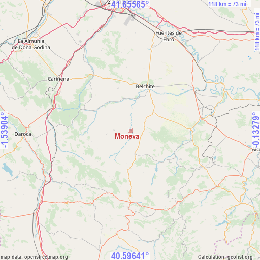
| Upper-left | 41.65565°, | -1.53904° |
| Center: | 41.12817°, | -0.83591° |
| Lower-right: | 40.59641°, | -0.13279° |
| Map W x H: | 117.8×117.8 km | = 73.2×73.2mi |
| max Lat: | 43.74134° ⇑48.4% North |
| Moneva: | 41.12817° |
| min Lat: | ⇓51.6% South 27.64134° |
| min Long | Moneva | max Long |
| -18.00367° | -0.83591° | 4.2899° |
| W 78.4%⇐ | ⇒21.6% E |
Elevation
Elevation of Moneva is 657 m = 2156 ft, and this is 59 m = 194 ft above average elevation for this country.
| Max E: |
1682 m = 5518 ft | 50% |
| Moneva | 657 m 2156 ft | |
| Avg. | 598 m = 1962 ft | |
Min E: |
0 m = 0 ft | 50% |
See also: Spain elevation on elevation.city.
Geographical zone
Moneva is located in North temperate zone (between Tropic of Cancer and the Arctic Circle). Distance of this Northern Tropic circle is 1967.1 km =1222.3 mi to South.| Distance of | km | miles | from Moneva |
|---|---|---|---|
| North Pole | 5434 | 3376.5 | to North |
| Arctic Circle | 2828.2 | 1757.4 | to North |
| Tropic Cancer | 1967.1 | 1222.3 | to South |
| Equator | 4573 | 2841.5 | to South |


Nearby cities:
15 places around Moneva: (largest is in red/bold)
• Alacón
16.2 km =10.1 mi,  134°
134°
• Almonacid de la Cuba
17.3 km =10.7 mi,  12°
12°
• Azuara
14.8 km =9.2 mi,  348°
348°
• Blesa
9.5 km =5.9 mi,  205°
205°
• Cortes de Aragón
17.2 km =10.7 mi,  179°
179°
• Huesa del Común
14.8 km =9.2 mi, 207°
• Lagata
12.7 km =7.9 mi, 11°
• Letux
14.4 km =8.9 mi, 11°
• Lécera
13.5 km =8.4 mi,  50°
50°
• Monforte de Moyuela
17 km =10.6 mi,  241°
241°
• Moyuela
7.2 km =4.5 mi,  269°
269°
• Muniesa
10.8 km =6.7 mi,  169°
169°
• Plenas
10.9 km =6.8 mi,  260°
260°
• Plou
15.1 km =9.4 mi,  185°
185°
• Samper del Salz
11.9 km =7.4 mi,  4°
4°
Sources, notices
• [Note1] Compared only with cities in Spain existing in our database
• [Src1] Map data: © OpenStreetMap contributors (CC-BY-SA)
• [Src2] Other city data from geonames.org with taken over terms of usage.
• [Src3] Geographical zone / Annual Mean Temperature by Robert A. Rohde @ Wikipedia
