Maire de Castroponce geodata
Maire de Castroponce (Castille and León) is a seat of a third-order administrative division; located in Spain in Europe/Madrid (GMT+2) time zone. With population of 227 people, there are 4876 cities with bigger population in this country. Compared to other cities in Spain, 76.8% of cities are located further ↓South; 83.1% of cities are located further →East and 59.6% of cities have lower elevation than Maire de Castroponce. Note1
Administrative division(s):
- Level 1: Castille and León
- Level 2: Provincia de Zamora
- Level 3: Maire de Castroponce


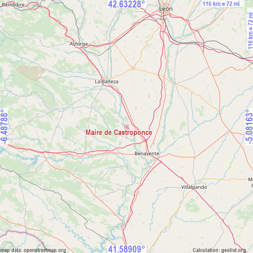
Maire de Castroponce GPS coordinates[2]
42° 6' 46.188" North, 5° 47' 5.1" West
| Map corner | latitude | longitude |
|---|---|---|
| Upper-left | 42.63228°, | -6.48788° |
| Center: | 42.11283°, | -5.78475° |
| Lower-right: | 41.58909°, | -5.08163° |
| Map W x H: | 116×116 km | = 72.1×72.1mi |
| max Lat: | 43.74134° ⇑23.2% North |
| Maire de Castroponce: | 42.11283° |
| min Lat: | ⇓76.8% South 27.64134° |
| min Long | Maire de Castro | max Long |
| -18.00367° | -5.78475° | 4.2899° |
| W 16.9%⇐ | ⇒83.1% E |
Elevation
Elevation of Maire de Castroponce is 742 m = 2434 ft, and this is 144 m = 472 ft above average elevation for this country.
| Max E: |
1682 m = 5518 ft | 40.4% |
| Maire de Castroponce | 742 m 2434 ft | |
| Avg. | 598 m = 1962 ft | |
Min E: |
0 m = 0 ft | 59.6% |
See also: Spain elevation on elevation.city.
Geographical zone
Maire de Castroponce is located in North temperate zone (between Tropic of Cancer and the Arctic Circle). Distance of this Northern Tropic circle is 2076.6 km =1290.3 mi to South.| Distance of | km | miles | from Maire de Castroponce |
|---|---|---|---|
| North Pole | 5324.6 | 3308.6 | to North |
| Arctic Circle | 2718.7 | 1689.3 | to North |
| Tropic Cancer | 2076.6 | 1290.3 | to South |
| Equator | 4682.5 | 2909.6 | to South |


Nearby cities:
15 places around Maire de Castroponce: (largest is in red/bold)
• Alija de los Melones
5 km =3.1 mi,  304°
304°
• Arrabalde
9.1 km =5.7 mi,  266°
266°
• Brime de Urz
11.1 km =6.9 mi,  221°
221°
• Coomonte
2.4 km =1.5 mi,  277°
277°
• Fresno de la Polvorosa
3.5 km =2.2 mi,  159°
159°
• La Antigua
10.7 km =6.6 mi,  46°
46°
• Manganeses de la Polvorosa
9.1 km =5.7 mi, 160°
• Pobladura del Valle
4.4 km =2.7 mi,  105°
105°
• Pozuelo del Páramo
6.6 km =4.1 mi,  11°
11°
• Quintanilla de Urz
10.3 km =6.4 mi,  210°
210°
• Quiruelas de Vidriales
11.2 km =7 mi,  199°
199°
• San Adrián del Valle
5 km =3.1 mi,  67°
67°
• Santa María de la Vega
3.7 km =2.3 mi, 212°
• Villabrázaro
8.1 km =5 mi,  144°
144°
• Villaferrueña
6.3 km =3.9 mi,  255°
255°
Sources, notices
• [Note1] Compared only with cities in Spain existing in our database
• [Src1] Map data: © OpenStreetMap contributors (CC-BY-SA)
• [Src2] Other city data from geonames.org with taken over terms of usage.
• [Src3] Geographical zone / Annual Mean Temperature by Robert A. Rohde @ Wikipedia
